Approximate Location Map
Large Map »
Latitude: 52.781 / 52°46'51"N
Longitude: -1.971 / 1°58'15"W
OS Eastings: 402052
OS Northings: 320385
OS Grid: SK020203
Mapcode National: GBR 39Z.LHN
Mapcode Global: WHBF2.PCMB
Plus Code: 9C4WQ2JH+CH
Entry Name: Wolseley Bridge
Listing Date: 17 March 1953
Grade: II
Source: Historic England
Source ID: 1319887
English Heritage Legacy ID: 443133
ID on this website: 101319887
Location: Bishton, Stafford, Staffordshire, ST17
County: Staffordshire
District: Stafford
Civil Parish: Colwich
Traditional County: Staffordshire
Lieutenancy Area (Ceremonial County): Staffordshire
Church of England Parish: Colwich St Michael and All Angels
Church of England Diocese: Lichfield
Tagged with: Road bridge
C0LWICH
l.
2385
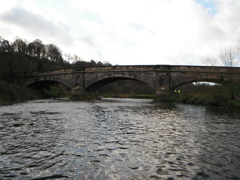
Wolseley Bridge
SK 02 SW 2/6 17.3.53.
II
2.
Probably late C18. A very graceful structure. Stone and of three spans
with segmental arches.
Listing NGR: SK0205220385
External links are from the relevant listing authority and, where applicable, Wikidata. Wikidata IDs may be related buildings as well as this specific building. If you want to add or update a link, you will need to do so by editing the Wikidata entry.


Other nearby listed buildings
