Latitude: 50.7991 / 50°47'56"N
Longitude: -3.1916 / 3°11'29"W
OS Eastings: 316123
OS Northings: 100625
OS Grid: ST161006
Mapcode National: GBR LX.YWTP
Mapcode Global: FRA 466Z.GFM
Plus Code: 9C2RQRX5+J9
Entry Name: 145, High Street
Listing Date: 6 July 1972
Grade: II
Source: Historic England
Source ID: 1319900
English Heritage Legacy ID: 443181
ID on this website: 101319900
Location: Honiton, East Devon, EX14
County: Devon
District: East Devon
Civil Parish: Honiton
Built-Up Area: Honiton
Traditional County: Devon
Lieutenancy Area (Ceremonial County): Devon
Church of England Parish: Honiton with Monkton
Church of England Diocese: Exeter
Tagged with: Building
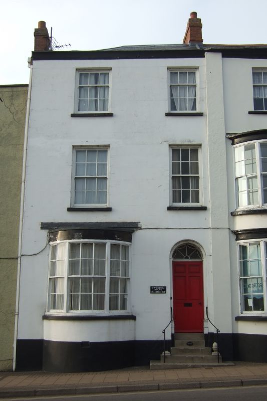
1. HIGH STREET
1228 (North Side)
No 145
ST 1600 1/120
II GY
2.
Early/Mid C19 building in external appearance with a possibly
older core. Rendered. 2 storeys and attic. Modern shopfront,
2 C19 sashes above, 2 dormers. Slate roof. Included for group
value.
Nos 143 to 157 (odd) form a group.
Listing NGR: ST1612300625
External links are from the relevant listing authority and, where applicable, Wikidata. Wikidata IDs may be related buildings as well as this specific building. If you want to add or update a link, you will need to do so by editing the Wikidata entry.


Other nearby listed buildings