Latitude: 52.5609 / 52°33'39"N
Longitude: -1.6311 / 1°37'51"W
OS Eastings: 425106
OS Northings: 295956
OS Grid: SP251959
Mapcode National: GBR 5HS.GFD
Mapcode Global: WHCHB.XWGN
Plus Code: 9C4WH969+8H
Entry Name: Hurley Hall and Attached Wall
Listing Date: 22 July 1953
Last Amended: 23 May 1988
Grade: II
Source: Historic England
Source ID: 1319917
English Heritage Legacy ID: 309280
ID on this website: 101319917
Location: North Warwickshire, CV9
County: Warwickshire
District: North Warwickshire
Civil Parish: Kingsbury
Traditional County: Warwickshire
Lieutenancy Area (Ceremonial County): Warwickshire
Church of England Parish: Baxterley
Church of England Diocese: Birmingham
Tagged with: Architectural structure
KINGSBURY ATHERSTONE LANE SP29NW (South-east side) Hurley Hall and attached wall 8/60 (Formerley listed as Hurley Hall and attached wail 22/07/53 Hall Hall)
GV ll
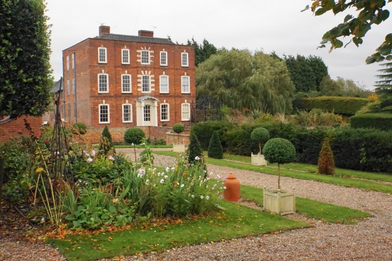
House c.1720. Flemish bond brick with painted stone dressings, and brick dentil string courses. Old plain-tile hipped roof behind parapet; brick ridge stacks. Double-depth plan. 3 storeys; 5 bays. Symmetrical front at right angles to road has slightly projecting end and central bays. Segmental arched glazed and panel led door; porch of painted stone fluted Tuscan pilasters and late C20 fibre glass colufltns with simple curved roof. Segmental-arched sashes have keystones with moulded cornices. Central bay has intermittent stone rustication to upper iluors. First floor has late C20) fixed-light window. Blocked windows to upper floors to first hay, and to second floor to central arid fifth bays. Left return side and rear are irregular. Interior is noted as having 3-bay hall with selection panelling and arch to open well staircase. Room to left has former open fireplace. Room behind hall has bolection panelling and bolection moulded fireplace with round-arched niche and fluted pilasters to left. Attached wall at right angles to left of entrance front has moulded stone copings, front section has concave quadrant curved end section. Partly collapsed The wall is approximately 0.8 metres high. (Buildings of England: Warwickshire pp3l5-316; VCH: Warwickshire: Vol IV, p99)
Listing NGR: SP2510695956
External links are from the relevant listing authority and, where applicable, Wikidata. Wikidata IDs may be related buildings as well as this specific building. If you want to add or update a link, you will need to do so by editing the Wikidata entry.


Other nearby listed buildings