Approximate Location Map
Large Map »
Latitude: 52.4793 / 52°28'45"N
Longitude: -1.6538 / 1°39'13"W
OS Eastings: 423612
OS Northings: 286880
OS Grid: SP236868
Mapcode National: GBR 5JQ.GQS
Mapcode Global: VHBWH.9Y26
Plus Code: 9C4WF8HW+PF
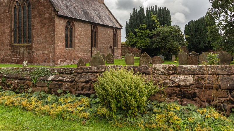
Entry Name: Churchyard wall approximately 20 metres east and north of Church of St. Michael and All Angels
Listing Date: 23 March 1988
Grade: II
Source: Historic England
Source ID: 1320117
English Heritage Legacy ID: 309011
ID on this website: 101320117
Location: Maxstoke, North Warwickshire, B46
County: Warwickshire
District: North Warwickshire
Civil Parish: Maxstoke
Traditional County: Warwickshire
Lieutenancy Area (Ceremonial County): Warwickshire
Church of England Parish: Maxstoke
Church of England Diocese: Birmingham
Tagged with: Churchyard wall
This list entry was subject to a Minor Amendment on 25/01/2019
SP 2386
17/106
MAXSTOKE
CHURCH ROAD (South side)
Churchyard wall approximately 20 metres east and north of Church of St. Michael and All Angels
(Formerly listed as Churchyard wall approximately 20 metres east and north of Church of St. Michael and All Saints)
GV
II
Wall. C17. Coursed sandstone rubble with gable coping.
Listing NGR: SP2361286880
External links are from the relevant listing authority and, where applicable, Wikidata. Wikidata IDs may be related buildings as well as this specific building. If you want to add or update a link, you will need to do so by editing the Wikidata entry.


Other nearby listed buildings
