Approximate Location Map
Large Map »
Latitude: 51.9062 / 51°54'22"N
Longitude: -0.7231 / 0°43'23"W
OS Eastings: 487941
OS Northings: 223848
OS Grid: SP879238
Mapcode National: GBR D1W.J0B
Mapcode Global: VHDTT.FC30
Plus Code: 9C3XW74G+FQ
Entry Name: Mounting Block 20 Yards East of Burcott House
Listing Date: 6 July 1984
Grade: II
Source: Historic England
Source ID: 1320143
English Heritage Legacy ID: 350850
ID on this website: 101320143
Location: Burcott, Buckinghamshire, LU7
County: Buckinghamshire
Civil Parish: Wing
Built-Up Area: Wing
Traditional County: Buckinghamshire
Lieutenancy Area (Ceremonial County): Buckinghamshire
Church of England Parish: Wing with Grove
Church of England Diocese: Oxford
Tagged with: Mounting block
SP 82 SE WING SOULBURY ROAD
(BURCOTT)
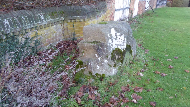
6/105 Mounting block 20 yards
east of Burcott House.
GV II
Mounting block. Dated W.A. 1746. Stone.
Listing NGR: SP8794123848
External links are from the relevant listing authority and, where applicable, Wikidata. Wikidata IDs may be related buildings as well as this specific building. If you want to add or update a link, you will need to do so by editing the Wikidata entry.


Other nearby listed buildings
