Latitude: 51.3656 / 51°21'56"N
Longitude: -2.5785 / 2°34'42"W
OS Eastings: 359822
OS Northings: 163108
OS Grid: ST598631
Mapcode National: GBR JR.T83D
Mapcode Global: VH891.8Y60
Plus Code: 9C3V9C8C+6J
Entry Name: Church Farmhouse
Listing Date: 21 September 1960
Grade: II
Source: Historic England
Source ID: 1320714
English Heritage Legacy ID: 33008
ID on this website: 101320714
Location: Stanton Drew, Bath and North East Somerset, Somerset, BS39
County: Bath and North East Somerset
Civil Parish: Stanton Drew
Traditional County: Somerset
Lieutenancy Area (Ceremonial County): Somerset
Tagged with: Farmhouse
ST 56 SE STANTON DREW C.P. CHURCH LANE (east side)
3/111 Church Farmhouse 21.9.60 G.V. II
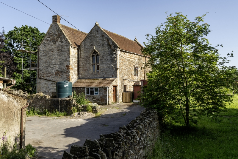
Farmhouse. C15, C17 additions, late C18 refronting to east, with C19 and C20 alterations. Limestone and sandstone rubble, stone dressings, double Roman tiled roof with raised coped verges; rendered to right return and rear, left return of limestone ashlar, concrete pantiled roof with brick gable stacks, pantiled lean-to. West range probably original church house, parallel east range. North front has 2 gable ends; to right, single storey lean-to with C20 3-light window and door, pantiled roof, at first floor stone mullion and transom window with cusped heads and quatrefoil, hood mould with finial and relieving arch; to left, later wing stepped forward, blank gable end. Right return has ground floor 4-pane light, 2 C20 lights and 2-light stone casement with chamfered mullion and hood mould, first floor has C19 2-light casement with timber lintel, one course of squared rubble below eaves; set back to right, lower it wing, ground floor C20 3-light casement and small 2-light casement under eaves. Left return of 2 storeys and 3 windows, ground and first floor left and right have paired sash, central first floor sash and central Cl9 gabled porch, inner panelled and glazed door, plinth, first floor cill string, cornice, parapet and coping. Rear has single storey lean-to with door and 2 C20 windows, 8-pane sash at ground floor right. Interior: former external east wall of original building has 2 pointed arched stone doorways with convex inner moulding and chamfer, chimney breast between with end of timber lintel visible; C19 open-well stair to south west, east range has central entrance hall; blocked first floor window to south. (Sources: Williams, E.H.D. : unpublished survey. 1981. RCHM).
Listing NGR: ST5982263108
External links are from the relevant listing authority and, where applicable, Wikidata. Wikidata IDs may be related buildings as well as this specific building. If you want to add or update a link, you will need to do so by editing the Wikidata entry.


Other nearby listed buildings