Approximate Location Map
Large Map »
Latitude: 51.5386 / 51°32'18"N
Longitude: -2.3991 / 2°23'56"W
OS Eastings: 372413
OS Northings: 182262
OS Grid: ST724822
Mapcode National: GBR JZ.GC74
Mapcode Global: VH95T.CLJC
Plus Code: 9C3VGJQ2+C8
Entry Name: 11, Rounceval Street
Listing Date: 29 July 1983
Grade: II
Source: Historic England
Source ID: 1320879
English Heritage Legacy ID: 34187
ID on this website: 101320879
Location: Chipping Sodbury, South Gloucestershire, BS37
County: South Gloucestershire
Civil Parish: Sodbury
Built-Up Area: Chipping Sodbury
Traditional County: Gloucestershire
Lieutenancy Area (Ceremonial County): Gloucestershire
Church of England Parish: Chipping Sodbury St John the Baptist
Church of England Diocese: Gloucester
Tagged with: Building
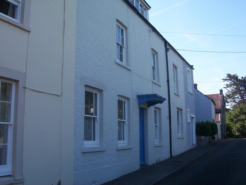
ST 7282 SW SODBURY ROUNCEVAL STREET
4/137 (north side)
THE PARADE
No 11
GV
II
Early-mid C19. Render, slate roof. Two storeys and attic with modern dormer. Three
windows, glazing bar sashes at upper floor, marginal glazed sashes to ground floor.
Flat wooden hood on brackets over door.
Listing NGR: ST7241382262
External links are from the relevant listing authority and, where applicable, Wikidata. Wikidata IDs may be related buildings as well as this specific building. If you want to add or update a link, you will need to do so by editing the Wikidata entry.


Other nearby listed buildings
