Approximate Location Map
Large Map »
Latitude: 51.4971 / 51°29'49"N
Longitude: -2.5139 / 2°30'49"W
OS Eastings: 364424
OS Northings: 177702
OS Grid: ST644777
Mapcode National: GBR CV2.65
Mapcode Global: VH88H.CMWN
Plus Code: 9C3VFFWP+VF
Entry Name: Turnpike Boundary Post on Cleeve Road Bridge
Listing Date: 3 August 1984
Grade: II
Source: Historic England
Source ID: 1321087
English Heritage Legacy ID: 35092
ID on this website: 101321087
Location: Frenchay, South Gloucestershire, BS16
County: South Gloucestershire
Civil Parish: Downend and Bromley Heath
Built-Up Area: Bristol
Traditional County: Gloucestershire
Lieutenancy Area (Ceremonial County): Gloucestershire
Church of England Parish: Downend
Church of England Diocese: Bristol
Tagged with: Boundary marker Pole
WINTERBOURNE
CLEEVE ROAD, Frenchay
ST 67 NW
3/35
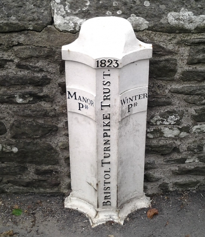
Turnpike boundary post on Cleeve Road Bridge
G.V.
II
Turnpike boundary marker. Dated 1823. Cast iron. A low post with
3 concave faces and cornice, now somewhat obscured by tarmac. Central text
reads "BRISTOL TURNPIKE TRUST - 1823" ; one side reads "MANOR P H", the other
"WINTER P H". Set in parapet wall of Cleeve Road Bridge (q.v.).
Listing NGR: ST6442477702
External links are from the relevant listing authority and, where applicable, Wikidata. Wikidata IDs may be related buildings as well as this specific building. If you want to add or update a link, you will need to do so by editing the Wikidata entry.


Other nearby listed buildings
