Latitude: 51.8599 / 51°51'35"N
Longitude: -0.3525 / 0°21'8"W
OS Eastings: 513553
OS Northings: 219206
OS Grid: TL135192
Mapcode National: GBR H6Y.7QV
Mapcode Global: VHFRN.VJ11
Plus Code: 9C3XVJ5X+X2
Entry Name: Laburnum Farmhouse
Listing Date: 26 September 1980
Grade: II
Source: Historic England
Source ID: 1321300
English Heritage Legacy ID: 36031
ID on this website: 101321300
Location: Chiltern Green, Central Bedfordshire, LU2
County: Central Bedfordshire
Civil Parish: Hyde
Traditional County: Bedfordshire
Lieutenancy Area (Ceremonial County): Bedfordshire
Church of England Parish: Harpenden
Church of England Diocese: St.Albans
Tagged with: Farmhouse
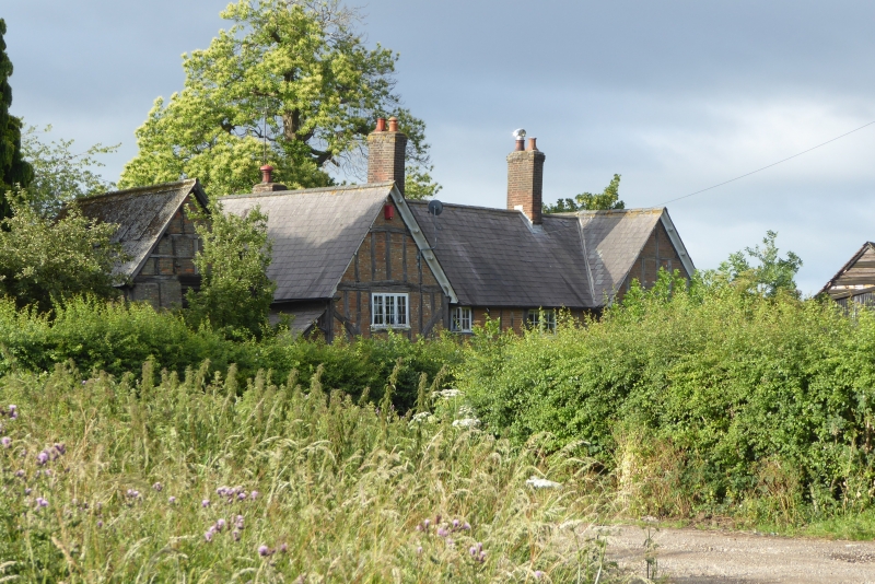
1.
5125 HYDE CHILTERN GREEN
Laburnum Farmhouse
TL 11 NW 44/215
II
2.
C17 H-plan with extensive additions but few subtractions. Timber-framed but exterior
cased in mainly modern materials. Two front side-wings oversailing. Slated roof.
Pebble dash and mock timber first floor above brick ground floor.
Listing NGR: TL1355319206
External links are from the relevant listing authority and, where applicable, Wikidata. Wikidata IDs may be related buildings as well as this specific building. If you want to add or update a link, you will need to do so by editing the Wikidata entry.


Other nearby listed buildings