Approximate Location Map
Large Map »
Latitude: 52.031 / 52°1'51"N
Longitude: -0.4965 / 0°29'47"W
OS Eastings: 503242
OS Northings: 238025
OS Grid: TL032380
Mapcode National: GBR G39.M91
Mapcode Global: VHFQT.B6WV
Plus Code: 9C4X2GJ3+CC
Entry Name: 12, Claridges Lane
Listing Date: 16 March 1972
Grade: II
Source: Historic England
Source ID: 1321442
English Heritage Legacy ID: 37376
ID on this website: 101321442
Location: Ampthill, Central Bedfordshire, MK45
County: Central Bedfordshire
Civil Parish: Ampthill
Built-Up Area: Ampthill
Traditional County: Bedfordshire
Lieutenancy Area (Ceremonial County): Bedfordshire
Church of England Parish: Ampthill
Church of England Diocese: St.Albans
Tagged with: Building
1.
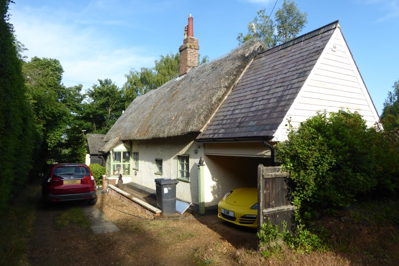
774 CLARIDGES LANE
No 12
TL 0338 1/157
II
2.
C17 or C18. Whitewashed roughcast, thatch. One storey and attic, casements;
3 gables, partly weatherboarded, each with one casement.
Listing NGR: TL0324238025
External links are from the relevant listing authority and, where applicable, Wikidata. Wikidata IDs may be related buildings as well as this specific building. If you want to add or update a link, you will need to do so by editing the Wikidata entry.


Other nearby listed buildings
