Latitude: 52.0323 / 52°1'56"N
Longitude: -0.4914 / 0°29'28"W
OS Eastings: 503589
OS Northings: 238176
OS Grid: TL035381
Mapcode National: GBR G39.GLG
Mapcode Global: VHFQT.F5LV
Plus Code: 9C4X2GJ5+WC
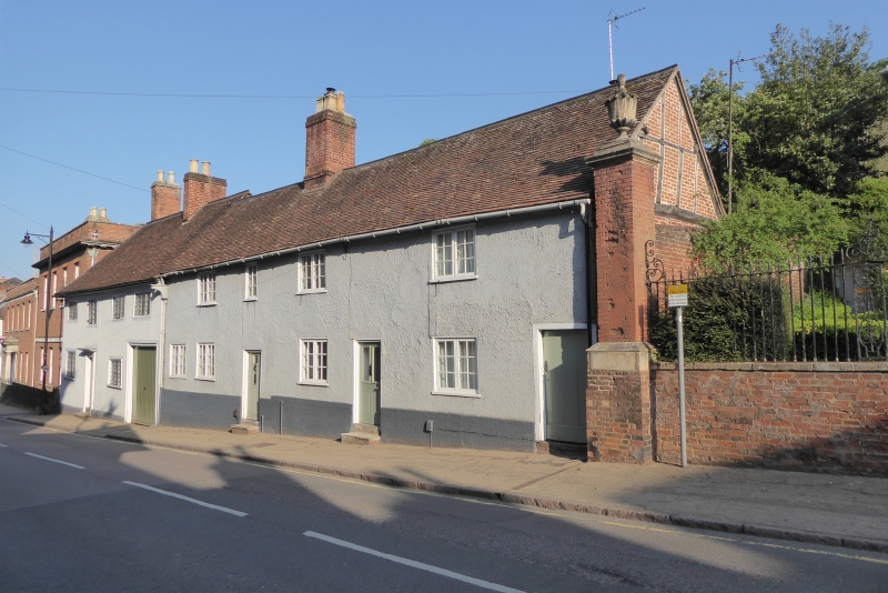
Entry Name: 24 and 26, Church Street
Listing Date: 16 March 1972
Grade: II
Source: Historic England
Source ID: 1321476
English Heritage Legacy ID: 37346
ID on this website: 101321476
Location: Ampthill, Central Bedfordshire, MK45
County: Central Bedfordshire
Civil Parish: Ampthill
Built-Up Area: Ampthill
Traditional County: Bedfordshire
Lieutenancy Area (Ceremonial County): Bedfordshire
Church of England Parish: Ampthill
Church of England Diocese: St.Albans
Tagged with: Building
1. 774 CHURCH STREET (North Side)
Nos 24 and 26 TL 0338 1/18
II GV
2. Early C18 refacing of earlier structure. Brick footing, rough plaster. 2 storeys. Tiled roof. Half-timbered gable end on east with red brick nogging. 4 flush casements, glazing bars.
Nos 24, 26, Nos 1 to 7 (consec) (Feoffe Almshouses) and, Parish Church of St Andrews form a group.
Also Nos 12 to 32 (even) form a group.
Listing NGR: TL0358938176
External links are from the relevant listing authority and, where applicable, Wikidata. Wikidata IDs may be related buildings as well as this specific building. If you want to add or update a link, you will need to do so by editing the Wikidata entry.


Other nearby listed buildings