Approximate Location Map
Large Map »
Latitude: 52.2497 / 52°14'58"N
Longitude: -0.632 / 0°37'55"W
OS Eastings: 493490
OS Northings: 262163
OS Grid: SP934621
Mapcode National: GBR DZ2.WKM
Mapcode Global: VHFPL.0Q87
Plus Code: 9C4X69X9+V6
Entry Name: Hinwick Bridge
Listing Date: 27 August 1987
Grade: II
Source: Historic England
Source ID: 1321506
English Heritage Legacy ID: 37142
ID on this website: 101321506
Location: Hinwick, Bedford, Bedfordshire, NN29
County: Bedford
Civil Parish: Podington
Traditional County: Bedfordshire
Lieutenancy Area (Ceremonial County): Bedfordshire
Church of England Parish: Podington with Farndish
Church of England Diocese: St.Albans
Tagged with: Bridge
PODINGTON HINWICK
SP 9262-9362
15/373 Hinwick Bridge
-
- II
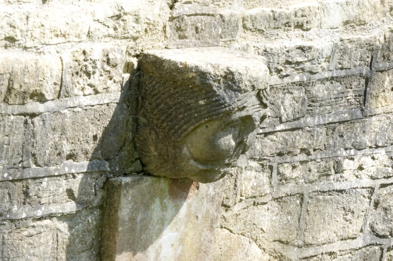
Bridge. Built 1779 by Mr Orlebar (owner of Hinwick House). Coursed
limestone rubble with rubble stone gable coping to parapet. Three arches
divided into three orders. Plain keystones with carved human heads above.
Cutwaters to S.W. side.
Listing NGR: SP9349062163
External links are from the relevant listing authority and, where applicable, Wikidata. Wikidata IDs may be related buildings as well as this specific building. If you want to add or update a link, you will need to do so by editing the Wikidata entry.


Other nearby listed buildings
