Approximate Location Map
Large Map »
Latitude: 52.2092 / 52°12'32"N
Longitude: -0.5888 / 0°35'19"W
OS Eastings: 496525
OS Northings: 257708
OS Grid: SP965577
Mapcode National: GBR DZQ.FZ2
Mapcode Global: VHFPS.RQ3T
Plus Code: 9C4X6C56+MF
Entry Name: The Bell Inn
Listing Date: 13 July 1964
Grade: II
Source: Historic England
Source ID: 1321529
English Heritage Legacy ID: 37081
ID on this website: 101321529
Location: Odell, Bedford, Bedfordshire, MK43
County: Bedford
Civil Parish: Odell
Traditional County: Bedfordshire
Lieutenancy Area (Ceremonial County): Bedfordshire
Church of England Parish: Odell
Church of England Diocese: St.Albans
Tagged with: Inn Thatched pub
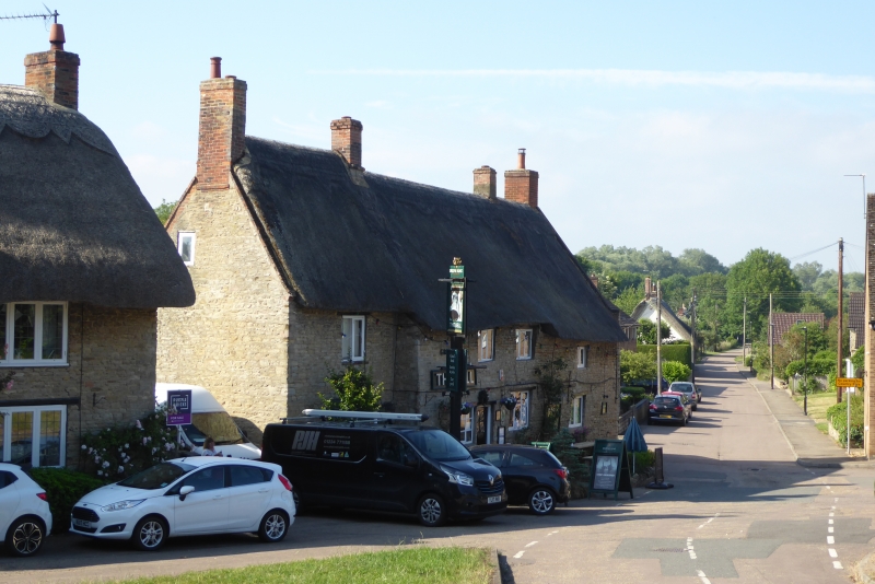
ODELL HIGH STREET
SP 9657 (South Side)
20/311 The Bell Inn
13.7.64
GV II
Inn of C17 origins, extended and modernised. Coursed limestone rubble,
thatched roof. Left hand wing slightly recessed, with ground floor bay
window. Two storeys. Main part has three ground floor casements with wooden
lintels over, and two similar first floor windows. Modern extensions at rear.
Listing NGR: SP9652557708
External links are from the relevant listing authority and, where applicable, Wikidata. Wikidata IDs may be related buildings as well as this specific building. If you want to add or update a link, you will need to do so by editing the Wikidata entry.


Other nearby listed buildings
