Latitude: 51.4531 / 51°27'11"N
Longitude: -0.9741 / 0°58'26"W
OS Eastings: 471379
OS Northings: 173183
OS Grid: SU713731
Mapcode National: GBR QLG.9J
Mapcode Global: VHDWT.2QCW
Plus Code: 9C3XF23G+79
Entry Name: Culvert on Holy Brook Running South Westwards from SU71441/73234 to 71327/73133
Listing Date: 24 October 1984
Last Amended: 26 November 1985
Grade: II*
Source: Historic England
Source ID: 1321866
English Heritage Legacy ID: 39268
ID on this website: 101321866
Location: Reading, Berkshire, RG1
County: Reading
Electoral Ward/Division: Abbey
Parish: Non Civil Parish
Built-Up Area: Reading
Traditional County: Berkshire
Lieutenancy Area (Ceremonial County): Berkshire
Church of England Parish: Reading St Giles
Church of England Diocese: Oxford
Tagged with: Architectural structure
In the entry for REAR OF CASTLE STREET
Nos 1-31 (odd)
2/620 South Side)
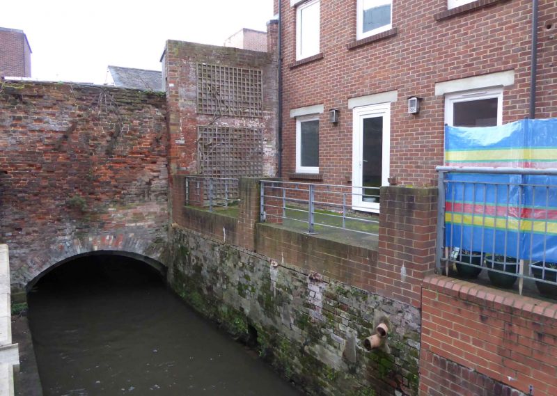
Culvert on Holy Brook running
south westwards from SU 7145/7320
to SU 7132/7314.
The address shall be amended to read REAR OF CASTLE STREET
Nos 1-31 (odd)
(South Side)
Culvert on Holy Brook running
south westwards from SU 71441/73234
to 71327/73133.
------------------------------------
REAR OF CASTLE STREET
1.
5128
NOS 1-31 (ODD)
(South side)
---------------
Culvert on Holy Brook running
south westwards from SU7145/
7320 to SU7132/7314
SU 7173 SW 2/620
II*
2.
Culvert. Late C16 to C18 with C19 & 20 repairs, incorporating some carved & moulded
stones of possibly Cll or C12. Brick with stone and some concrete. Approximately
160 metres of culvert averaging 3 metres wide and 1.5 metres high. The base of the
walls are of dressed stone and support brick and stone vaulting in the form of a
depressed arch. Working eastwards, first section approx. 50 metres long in C18
brick followed by 10 metres of concrete repairs ending in an arch of re-used
stone with roll mould; approx 17 metres of brick vaulting ending in an arch with
a moulded keystone; approx. 18 metres of stone vaulting formed of irregular dressed
stones incorporating some carved stones with chevron and volute ornaments of
possibly C11 ending in a brick arch of late C16 bricks; approx. 15 metres of moulded
stone ribbed arches set in parallel to form continuous vault, the stone ribs being
re-used stones of possibly C12, 40 ribs in all; approx. 8 metres of late C16
brickwork forming vault; the remainder of the culvert is C18 & 19 brick vaulting
of varying widths and incorporating C20 repairs.
Listing NGR: SU7133773209
External links are from the relevant listing authority and, where applicable, Wikidata. Wikidata IDs may be related buildings as well as this specific building. If you want to add or update a link, you will need to do so by editing the Wikidata entry.


Other nearby listed buildings