Latitude: 54.6086 / 54°36'30"N
Longitude: -2.0856 / 2°5'7"W
OS Eastings: 394571
OS Northings: 523717
OS Grid: NY945237
Mapcode National: GBR FHW4.8Q
Mapcode Global: WHB43.YF1B
Plus Code: 9C6VJW57+CQ
Entry Name: Byre House and Barn to Left of West Wood Farmhouse
Listing Date: 17 June 1986
Grade: II
Source: Historic England
Source ID: 1323047
English Heritage Legacy ID: 111281
ID on this website: 101323047
Location: Bowbank, County Durham, DL12
County: County Durham
Civil Parish: Lunedale
Traditional County: Yorkshire
Lieutenancy Area (Ceremonial County): County Durham
Tagged with: Cowshed
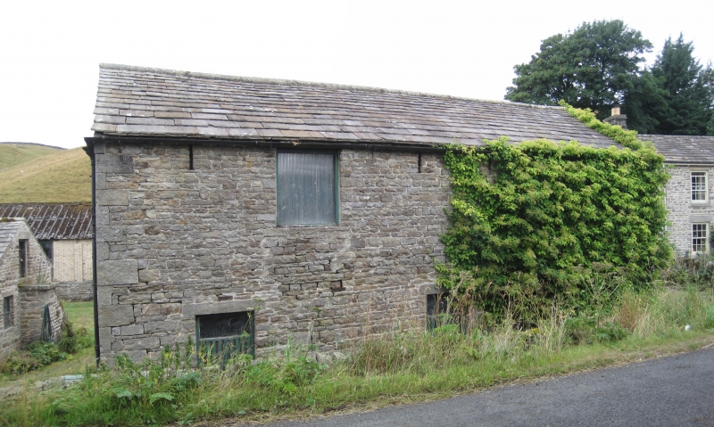
LUNEDALE B6276, Bowbank NY 92 SW (North side) 9/111 Byre-house and barn to left of West Wood Farmhouse GV II Barn and byre-house. Altered late C18 barn and byre. Byre formerly with domestic accommodation above. Squared rubble in alternating wide and narrow courses; stone-flagged roofs. Square-plan byre-house with barn attached at angle to left.
2-storey, one-bay byre-house with alternating quoins. Dutch door in flush surround with right jamb removed; small replaced 2-pane light in flush surround to right; square opening in similar surround above. Low-pitched roof. Left return has external stone stairway to boarded door.
2-storey, 3-bay barn with plinth and alternating quoins. Large round archway in front gable, with tooled voussoirs and alternating jambs. Low-pitched roof. Left return: 2 partly-glazed, hit-and-miss ground-floor windows; square opening and 3 breathers above. Owl hole in rear gable.
Detached farmbuildings to left and rear are not of special interest.
Listing NGR: NY9457123717
External links are from the relevant listing authority and, where applicable, Wikidata. Wikidata IDs may be related buildings as well as this specific building. If you want to add or update a link, you will need to do so by editing the Wikidata entry.


Other nearby listed buildings