Latitude: 54.7358 / 54°44'8"N
Longitude: -1.6557 / 1°39'20"W
OS Eastings: 422267
OS Northings: 537927
OS Grid: NZ222379
Mapcode National: GBR JFWP.B3
Mapcode Global: WHC4W.J7S8
Plus Code: 9C6WP8PV+8P
Entry Name: 1, the Village
Listing Date: 10 May 1967
Grade: II
Source: Historic England
Source ID: 1323201
English Heritage Legacy ID: 109913
ID on this website: 101323201
Location: Brancepeth, County Durham, DH7
County: County Durham
Civil Parish: Brancepeth
Traditional County: Durham
Lieutenancy Area (Ceremonial County): County Durham
Church of England Parish: Brancepeth
Church of England Diocese: Durham
Tagged with: Building
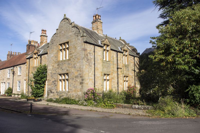
BRANCEPETH THE VILLAGE NZ 2237 (East side) 15/32 No. 1 10/5/67 (formerly listed as No. 1 Brancepeth) GV II House. Mid C19 for Brancepeth Estate. Tooled snecked sandstone with ashlar dressings. Graduated green slate roof with ashlar chimney stacks. Jacobean style. 2 storeys, 3 bays, the right bay projecting and cross gabled. Chamfered plinth. Central 4-panel door and overlight in moulded, shoulder- headed doorway. Double-chamfered, stone-mullioned windows. Cross window on ground floor of left bay, and above in gabled half dormer with ball finials. Right bay has 3-light windows and shaped gable with chamfered coping and ball finials. Steeply-pitched roof has coped left gable and square kneeler with ball finial. Corniced square-plan stacks with ornamental chimney pots at left end and on right ridge. 2-bay right return has cross windows on ground floor and in identical half dormers; shaped gable to rear. C20 rear additions are not of interest. Nos. 1 to 12 (consecutive) form a continuous row.
Listing NGR: NZ2226737927
External links are from the relevant listing authority and, where applicable, Wikidata. Wikidata IDs may be related buildings as well as this specific building. If you want to add or update a link, you will need to do so by editing the Wikidata entry.


Other nearby listed buildings