Latitude: 50.7982 / 50°47'53"N
Longitude: -1.9961 / 1°59'45"W
OS Eastings: 400371
OS Northings: 99851
OS Grid: SZ003998
Mapcode National: GBR 31M.S70
Mapcode Global: FRA 66QZ.D6B
Plus Code: 9C2WQ2X3+7H
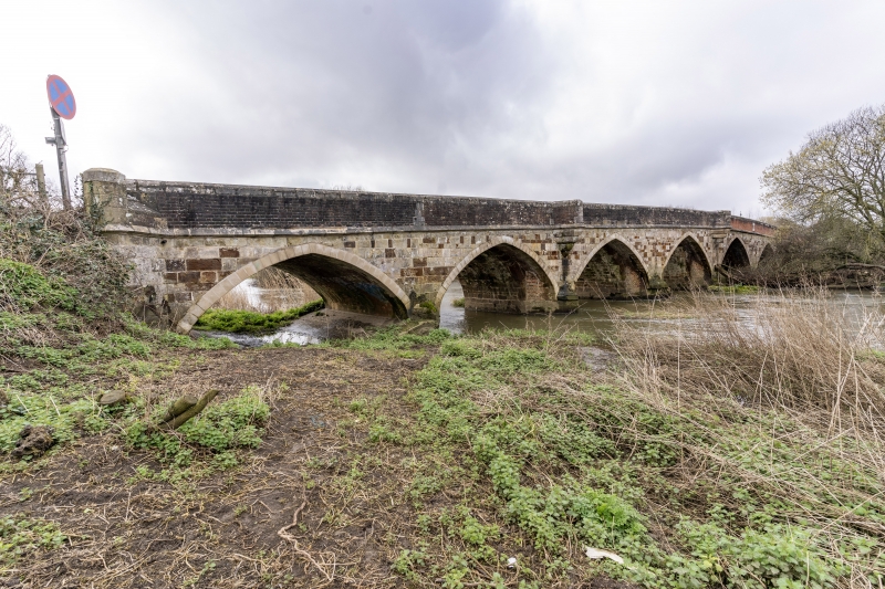
Entry Name: Julian's Bridge
Listing Date: 14 June 1952
Grade: I
Source: Historic England
Source ID: 1323805
English Heritage Legacy ID: 107087
ID on this website: 101323805
Location: Wimborne Minster, Dorset, BH21
County: Dorset
Civil Parish: Pamphill
Built-Up Area: Wimborne Minster
Traditional County: Dorset
Lieutenancy Area (Ceremonial County): Dorset
Church of England Parish: Canford Magna
Church of England Diocese: Salisbury
Tagged with: Road bridge
The asset was previously listed twice also under the parish of Pamphill at List Entry 1323805.
This entry was subject to a Minor Amendment on 20 July 2022 to remove references to the duplicate list entry and to reformat text to current standards.
5193
SZ 0099 NW 2/63
JULIAN'S ROAD
Julian's Bridge
14.6.52
I
Probably late C15 with C17 alterations. Stone with brick parapet and chamfered stone coping. Eight pointed arches with ribs and pointed cutwaters. The bridge has been widened on the south side. Each side has three pointed pedestrian niches.
External links are from the relevant listing authority and, where applicable, Wikidata. Wikidata IDs may be related buildings as well as this specific building. If you want to add or update a link, you will need to do so by editing the Wikidata entry.


Other nearby listed buildings