Latitude: 50.7162 / 50°42'58"N
Longitude: -2.4372 / 2°26'14"W
OS Eastings: 369227
OS Northings: 90823
OS Grid: SY692908
Mapcode National: GBR PY.RFWL
Mapcode Global: FRA 57S5.VR1
Plus Code: 9C2VPH87+F4
Entry Name: 43 and 44, Colliton Street
Listing Date: 8 May 1975
Grade: II
Source: Historic England
Source ID: 1324412
English Heritage Legacy ID: 104233
ID on this website: 101324412
Location: Dorchester, Dorset, DT1
County: Dorset
Civil Parish: Dorchester
Built-Up Area: Dorchester
Traditional County: Dorset
Lieutenancy Area (Ceremonial County): Dorset
Church of England Parish: Dorchester and West Stafford
Church of England Diocese: Salisbury
Tagged with: Building
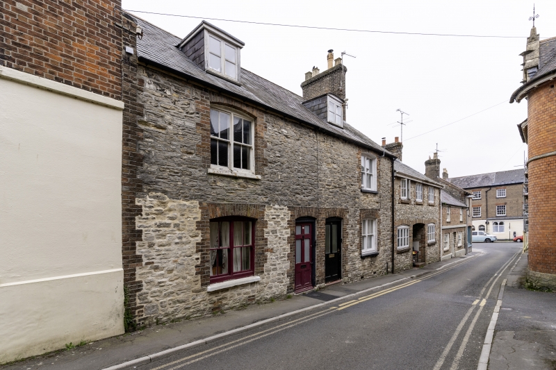
COLLITON STREET 1. 5191 (North Side) Nos 43 and 44 SY 6990 7/157 II GV 2. Early C19. Portland or Ridgeway rubble. Brick dressings. 2 storeys and attics. 2 ranges of paned sashes in segment-headed openings. 2 attic dormers with casements. 2 part-glazed doors. Nos 34 to 36 (consec) Nos 42 to 44 (consec) The Forge and The Forge Cottage form a group.
Listing NGR: SY6922390824
External links are from the relevant listing authority and, where applicable, Wikidata. Wikidata IDs may be related buildings as well as this specific building. If you want to add or update a link, you will need to do so by editing the Wikidata entry.


Other nearby listed buildings