Latitude: 51.0081 / 51°0'29"N
Longitude: -2.1968 / 2°11'48"W
OS Eastings: 386289
OS Northings: 123209
OS Grid: ST862232
Mapcode National: GBR 1XH.PDV
Mapcode Global: FRA 669G.00D
Plus Code: 9C3V2R53+67
Entry Name: 16, Haimes Lane
Listing Date: 15 October 1973
Grade: II
Source: Historic England
Source ID: 1324795
English Heritage Legacy ID: 102034
ID on this website: 101324795
Location: Shaftesbury, Dorset, SP7
County: Dorset
Civil Parish: Shaftesbury
Built-Up Area: Shaftesbury
Traditional County: Dorset
Lieutenancy Area (Ceremonial County): Dorset
Church of England Parish: Shaftesbury St Peter
Church of England Diocese: Salisbury
Tagged with: Building
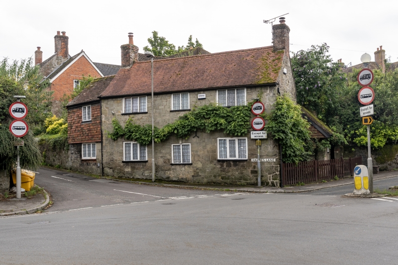
1.
1615 HAIMES LANE
(South-West Side)
No 16
ST 8623 1/43
II
2.
Cl8. 2 storeys. 3 windows. Modern red plain tile roof with 2 small stacks.
Stone rubble front. 3-light casement windows with small leaded panes.
2-light casement window in centre on 1st floor. Lower windows and doorway
have stone voussoirs with keystone. Wooden boarded door in frame.
Listing NGR: ST8628923209
External links are from the relevant listing authority and, where applicable, Wikidata. Wikidata IDs may be related buildings as well as this specific building. If you want to add or update a link, you will need to do so by editing the Wikidata entry.


Other nearby listed buildings