Approximate Location Map
Large Map »
Latitude: 51.3607 / 51°21'38"N
Longitude: 1.0233 / 1°1'23"E
OS Eastings: 610574
OS Northings: 166747
OS Grid: TR105667
Mapcode National: GBR TX1.MJQ
Mapcode Global: VHKJR.P2B5
Plus Code: 9F33926F+78
Entry Name: The Pearsons Arms Public House
Listing Date: 20 May 1977
Grade: II
Source: Historic England
Source ID: 1325192
English Heritage Legacy ID: 170868
ID on this website: 101325192
Location: Whitstable, Canterbury, Kent, CT5
County: Kent
District: Canterbury
Electoral Ward/Division: Gorrell
Parish: Non Civil Parish
Built-Up Area: Whitstable
Traditional County: Kent
Lieutenancy Area (Ceremonial County): Kent
Tagged with: Pub
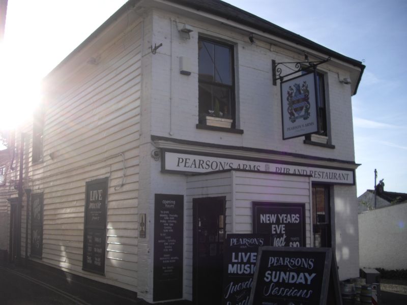
SEA WALL
1.
5273
(North-West Side)
The Pearsons Arms
Public House
TR 1066 NE 1/185
II
2.
Early C19 timber-framed and weatherboarded building. 2 storeys, slate roof. Mid
C19 brick addition with half cant and hip slated roof. Box sash windows throughbut
with glazing bars complete.
Listing NGR: TR1057466747
External links are from the relevant listing authority and, where applicable, Wikidata. Wikidata IDs may be related buildings as well as this specific building. If you want to add or update a link, you will need to do so by editing the Wikidata entry.


Other nearby listed buildings
