Approximate Location Map
Large Map »
Latitude: 54.5469 / 54°32'48"N
Longitude: -3.1547 / 3°9'17"W
OS Eastings: 325400
OS Northings: 517461
OS Grid: NY254174
Mapcode National: GBR 6HDV.TV
Mapcode Global: WH70D.HZZ5
Plus Code: 9C6RGRWW+Q4
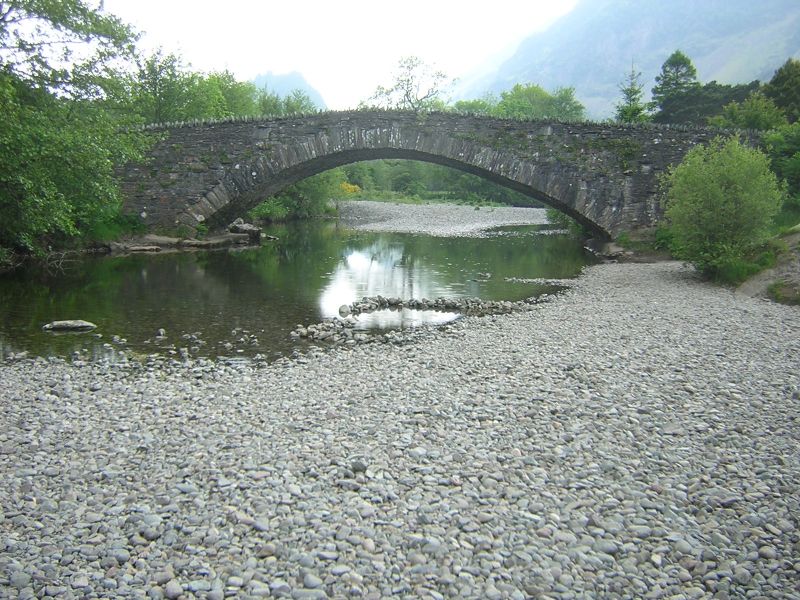
Entry Name: Grange Bridge
Listing Date: 3 March 1967
Grade: II
Source: Historic England
Source ID: 1325550
English Heritage Legacy ID: 72133
ID on this website: 101325550
Location: Grange, Cumberland, Cumbria, CA12
County: Cumbria
District: Allerdale
Civil Parish: Borrowdale
Traditional County: Cumberland
Lieutenancy Area (Ceremonial County): Cumbria
Church of England Parish: Borrowdale St Andrew
Church of England Diocese: Carlisle
Tagged with: Road bridge
NY 21 NE BORROWDALE GRANGE
16/49 Grange Bridge
3.3.67
II
Roadbridge. Rebuilt early C19. Slate rubble. Double continuous bridge over
twin arms of the River Derwent. Both of single width and single span with
humped backs. Arches have thin slate voussoirs under solid parapet with rubble
coping.
Listing NGR: NY2540017461
External links are from the relevant listing authority and, where applicable, Wikidata. Wikidata IDs may be related buildings as well as this specific building. If you want to add or update a link, you will need to do so by editing the Wikidata entry.


Other nearby listed buildings
