Latitude: 54.6661 / 54°39'58"N
Longitude: -2.7538 / 2°45'13"W
OS Eastings: 351475
OS Northings: 530377
OS Grid: NY514303
Mapcode National: GBR 9G6H.L3
Mapcode Global: WH814.NZV8
Plus Code: 9C6VM68W+FF
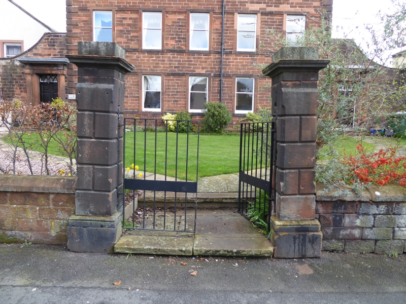
Entry Name: Gate Piers to Corney House
Listing Date: 9 February 1983
Grade: II
Source: Historic England
Source ID: 1326893
English Heritage Legacy ID: 72805
ID on this website: 101326893
Location: Penrith, Westmorland and Furness, Cumbria, CA11
County: Westmorland and Furness
District: Eden
Civil Parish: Penrith
Built-Up Area: Penrith
Traditional County: Cumberland
Lieutenancy Area (Ceremonial County): Cumbria
Church of England Parish: Penrith St Andrew
Church of England Diocese: Carlisle
Tagged with: Gatepost
1. 5165 CORNEY PLACE
Gate piers to Corney House NY 5130 1/56
II
2. 1777. Two square gate piers in centre front, rusticated stone, with cornices.
Listing NGR: NY5147530377
External links are from the relevant listing authority and, where applicable, Wikidata. Wikidata IDs may be related buildings as well as this specific building. If you want to add or update a link, you will need to do so by editing the Wikidata entry.


Other nearby listed buildings