Approximate Location Map
Large Map »
Latitude: 54.6048 / 54°36'17"N
Longitude: -3.1451 / 3°8'42"W
OS Eastings: 326128
OS Northings: 523894
OS Grid: NY261238
Mapcode National: GBR 6HG6.W2
Mapcode Global: WH706.NJJ7
Plus Code: 9C6RJV33+WX
Entry Name: 18, High Hill
Listing Date: 27 May 1977
Grade: II
Source: Historic England
Source ID: 1327120
English Heritage Legacy ID: 71777
ID on this website: 101327120
Location: High Hill, Cumberland, Cumbria, CA12
County: Cumbria
District: Allerdale
Civil Parish: Keswick
Built-Up Area: Keswick
Traditional County: Cumberland
Lieutenancy Area (Ceremonial County): Cumbria
Church of England Parish: Crosthwaite St Kentigern
Church of England Diocese: Carlisle
Tagged with: Building
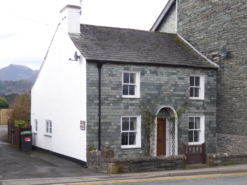
KESWICK HIGH HILL
1. ---------
5161
No 18
NY 2623 1/19
II GV
2.
Early C18, slate hung front, slate roof, 2 low storeys. Centre panelled door with
small wooden porch, 2 sash windows on each floor.
Listing NGR: NY2612823894
External links are from the relevant listing authority and, where applicable, Wikidata. Wikidata IDs may be related buildings as well as this specific building. If you want to add or update a link, you will need to do so by editing the Wikidata entry.


Other nearby listed buildings
