Approximate Location Map
Large Map »
Latitude: 50.216 / 50°12'57"N
Longitude: -5.4786 / 5°28'43"W
OS Eastings: 151930
OS Northings: 40904
OS Grid: SW519409
Mapcode National: GBR DXV3.P7P
Mapcode Global: VH12F.0T0S
Plus Code: 9C2P6G8C+CG
Entry Name: 49-55, Back Road
Listing Date: 22 December 1972
Grade: II
Source: Historic England
Source ID: 1327769
English Heritage Legacy ID: 68923
ID on this website: 101327769
Location: St Ives, Cornwall, TR26
County: Cornwall
Civil Parish: St. Ives
Built-Up Area: St Ives
Traditional County: Cornwall
Lieutenancy Area (Ceremonial County): Cornwall
Church of England Parish: St Ives
Church of England Diocese: Truro
Tagged with: Building
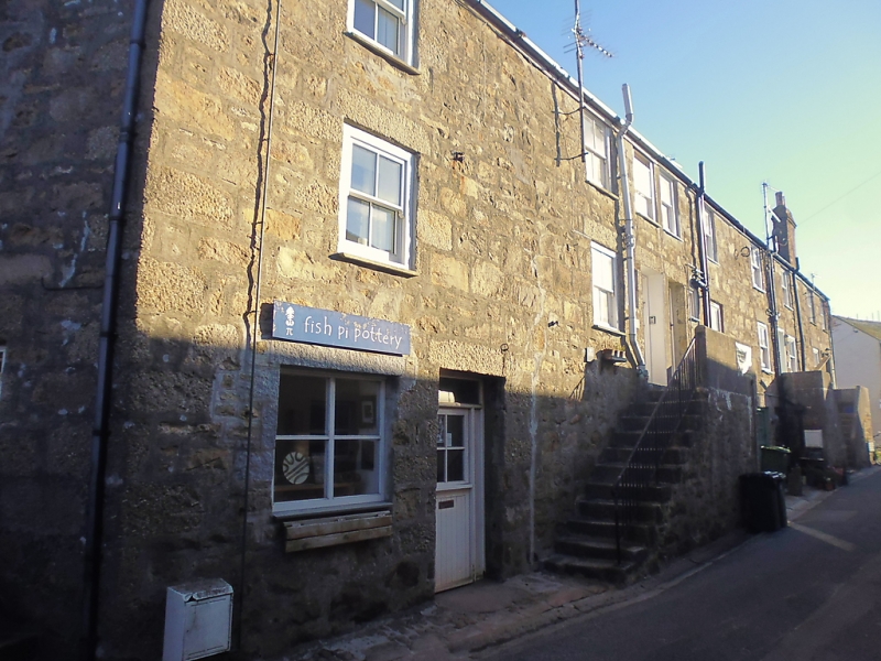
BACK ROAD
1. (North Side)
1587 ------------
Nos 49 to 55 (odd)
SW 54 SW 1/26
II GV
2.
Early C19. Ribble Three storeys. Nine windows overall, sashes, no glazing
bars. Steps to first floor doerways. Wide shop entrance on ground.
floor. Slate roof with gable ends. Group value.
Nos 35 to 55 (odd) and the Old Bakehouse form a group.
Listing NGR: SW5193040904
External links are from the relevant listing authority and, where applicable, Wikidata. Wikidata IDs may be related buildings as well as this specific building. If you want to add or update a link, you will need to do so by editing the Wikidata entry.


Other nearby listed buildings
