Approximate Location Map
Large Map »
Latitude: 50.2158 / 50°12'56"N
Longitude: -5.4769 / 5°28'36"W
OS Eastings: 152057
OS Northings: 40876
OS Grid: SW520408
Mapcode National: GBR DXV3.Q29
Mapcode Global: VH12F.0TYX
Plus Code: 9C2P6G8F+87
Entry Name: 10, St Eia Street
Listing Date: 22 December 1972
Grade: II
Source: Historic England
Source ID: 1327779
English Heritage Legacy ID: 69086
ID on this website: 101327779
Location: St Ives, Cornwall, TR26
County: Cornwall
Civil Parish: St. Ives
Built-Up Area: St Ives
Traditional County: Cornwall
Lieutenancy Area (Ceremonial County): Cornwall
Church of England Parish: St Ives
Church of England Diocese: Truro
Tagged with: Building
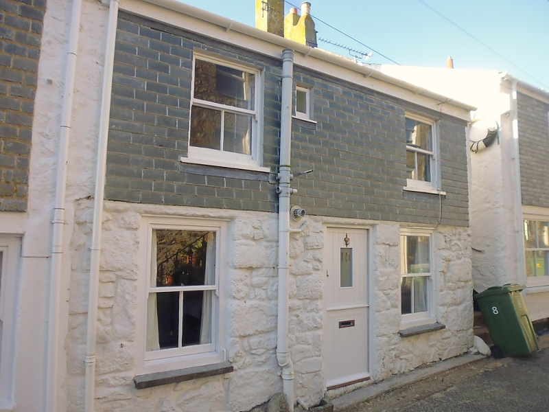
ST EIA STREET
1. (South Side)
1587 -------------
No 10
SW 54 SW 1/282
II GV
2.
Early Cl9 cottage. Rendered, vertical slated first floor. Two storeys,
Two stall sashes, no glazing bars. Central modern door. Slate roof. Group
value.
The listed buildings on the South Side form a group.
Listing NGR: SW5205740876
External links are from the relevant listing authority and, where applicable, Wikidata. Wikidata IDs may be related buildings as well as this specific building. If you want to add or update a link, you will need to do so by editing the Wikidata entry.


Other nearby listed buildings
