Approximate Location Map
Large Map »
Latitude: 50.1171 / 50°7'1"N
Longitude: -5.5456 / 5°32'44"W
OS Eastings: 146633
OS Northings: 30137
OS Grid: SW466301
Mapcode National: GBR DXPC.NM4
Mapcode Global: VH05H.TBM1
Plus Code: 9C2P4F83+VQ
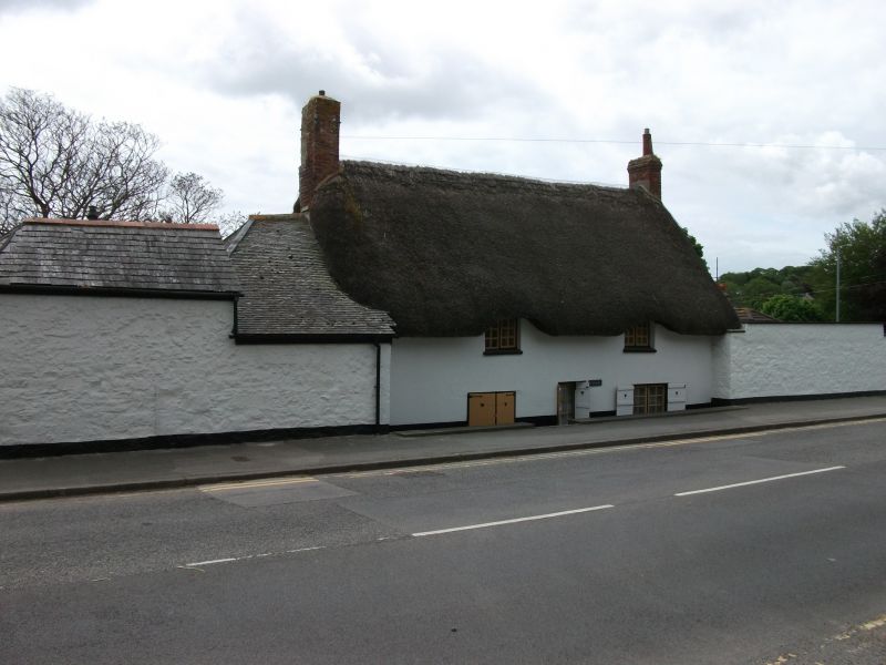
Entry Name: Hawk's Farm House
Listing Date: 29 July 1950
Last Amended: 7 February 1974
Grade: II
Source: Historic England
Source ID: 1327865
English Heritage Legacy ID: 69425
ID on this website: 101327865
Location: Penzance, Cornwall, TR18
County: Cornwall
Civil Parish: Penzance
Built-Up Area: Penzance
Traditional County: Cornwall
Lieutenancy Area (Ceremonial County): Cornwall
Church of England Parish: Penzance St Mary the Virgin with St Paul
Church of England Diocese: Truro
Tagged with: Farmhouse Thatched farmhouse
1.
1498 PENZANCE
ALVERTON ROAD
(South Side)
Hawk's Farm House
(formerly listed under
Alverne Hill)
SW 4630 6/9 29.7.50.
II
2.
C17/18. Stuccoed uncoursed rubble. Thatched roof with gable ends eyebrow
eaves over 1st floor windows. 2 storeys. 2 windows. Small 2-light casements
with thick glazing bars. Central doorway.
Listing NGR: SW4661330114
External links are from the relevant listing authority and, where applicable, Wikidata. Wikidata IDs may be related buildings as well as this specific building. If you want to add or update a link, you will need to do so by editing the Wikidata entry.


Other nearby listed buildings
