Latitude: 51.8387 / 51°50'19"N
Longitude: 0.3114 / 0°18'40"E
OS Eastings: 559336
OS Northings: 218089
OS Grid: TL593180
Mapcode National: GBR NGN.MK0
Mapcode Global: VHHM4.B1YS
Plus Code: 9F32R8Q6+FG
Entry Name: The Maltings
Listing Date: 17 October 1983
Grade: II
Source: Historic England
Source ID: 1328465
English Heritage Legacy ID: 352666
ID on this website: 101328465
Location: Great Canfield, Uttlesford, Essex, CM6
County: Essex
District: Uttlesford
Civil Parish: Great Canfield
Traditional County: Essex
Lieutenancy Area (Ceremonial County): Essex
Church of England Parish: Great Canfield St Mary
Church of England Diocese: Chelmsford
Tagged with: Architectural structure
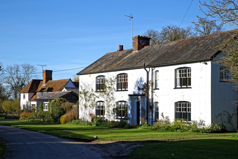
TL 51 NE GREAT CANFIELD CHURCH END
2/42 THE MALTINGS
GV II
Hall house with one crosswing, C15 and C17, altered in Cl9 and C20. Timber-
framed, plastered, roof tiled. Hall aligned NW-SE with integral service end at
SE. Floor inserted in hall, original crownpost roof rebuilt as clasped purlin
construction to gain headroom, one dormer inserted, crosswing built or rebuilt
with double hearth at junction of hall and crosswing, forming a lobby-
entrance, all early C17. Some reconstruction at service end, undatable,
involving rebuilding of side walls and roof. 2 storey crosswing, hall block
single storey with attics. Crosswing roof hipped, hall gabled at SE. On
ground floor, one C20 casement window, C20 door with early C19 hood,
2 C20 bay windows. On upper floor, one C20 casement window and 2 more in
hipped dormers. Framing exposed internally at SE end only. Lower SE wall
original, with curved tension bracing trenched outside studs, and grooves for
sliding shutters. Side walls rebuilt, with primary straight bracing. One
of a pair of twin service doorways with double ogee head exposed, the other
possibly present within the plaster. Floor of service end supported on
clamps pegged to wall (with original stair trap visible from below), indicating
that there may not have been an upper storey originally. In roof of hall,
original rafters trenched for crownpost construction, lightly smoke-
blackened, but crownposts removed. Also, fragment of hollow-moulded timber
with original red paint, re-used as a stud. T-plan stair NE of stack with
early C19 banister. The name, The Maltings, derives from a former building on
NW edge of site, recorded in tithe map and award of 1847, demolished.
Listing NGR: TL5933618089
External links are from the relevant listing authority and, where applicable, Wikidata. Wikidata IDs may be related buildings as well as this specific building. If you want to add or update a link, you will need to do so by editing the Wikidata entry.


Other nearby listed buildings