Latitude: 50.4821 / 50°28'55"N
Longitude: -4.5579 / 4°33'28"W
OS Eastings: 218626
OS Northings: 67828
OS Grid: SX186678
Mapcode National: GBR N9.LYYL
Mapcode Global: FRA 17BS.B56
Plus Code: 9C2QFCJR+VV
Entry Name: Walls Enclosing the Churchyard of Church of St Anietus Ot West and South, 2 Gateways to West and South East
Listing Date: 5 November 1987
Grade: II
Source: Historic England
Source ID: 1329214
English Heritage Legacy ID: 62276
ID on this website: 101329214
Location: St Neot's Church, St Neot, Cornwall, PL14
County: Cornwall
Civil Parish: St. Neot
Built-Up Area: St Neot
Traditional County: Cornwall
Lieutenancy Area (Ceremonial County): Cornwall
Church of England Parish: St Neot
Church of England Diocese: Truro
Tagged with: Wall
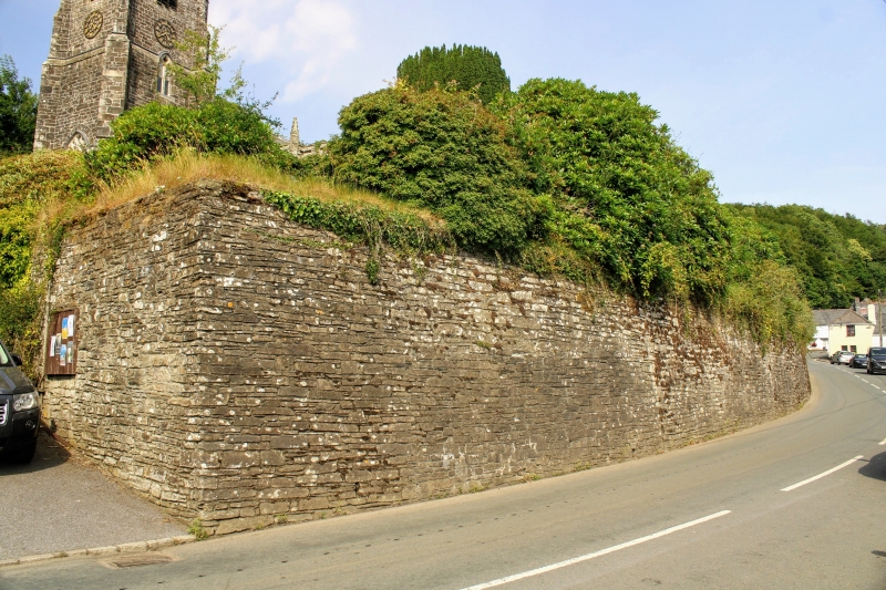
ST NEOT ST NEOT SX 16 NE 9/137 Walls enclosing the churchyard of - Church of St Anietus to west and south, 2 gateways to west and south east GV II Walls enclosing the churchyard to west and south, west gateway and south east gateway. Possibly originally of C16, with rebuilding of C19 and mid C19 gateways. Walls in slatestone rubble without coping; gateways in granite with granite steps and cast iron gates. The walls are about 4 metres high, according to the slope of the ground. The west gateway has a flight of 6 granite steps, walls to sides with plain granite coping. Pair of cast iron gates, with double mid rail with pattern of circles, knob finials to rails. Wrought iron overthrow with lamp. The rails are continued for about 2 metres to right and left, with knob finials. The south east gateway has 4 granite steps with rails to sides, granite jambs to the gateway, with pair of similar cast iron gates, also with wrought iron overthrow with lamp. Plain railings are continued for about 2 metres to the south on top of the churchyard wall.
Listing NGR: SX1849267850
External links are from the relevant listing authority and, where applicable, Wikidata. Wikidata IDs may be related buildings as well as this specific building. If you want to add or update a link, you will need to do so by editing the Wikidata entry.


Other nearby listed buildings