Latitude: 53.33 / 53°19'47"N
Longitude: -2.3854 / 2°23'7"W
OS Eastings: 374430
OS Northings: 381518
OS Grid: SJ744815
Mapcode National: GBR CYSY.C0
Mapcode Global: WH991.BKBJ
Plus Code: 9C5V8JH7+XR
Entry Name: Orangery
Listing Date: 20 September 1984
Grade: II
Source: Historic England
Source ID: 1329672
English Heritage Legacy ID: 58476
ID on this website: 101329672
Location: Tatton Dale, Cheshire East, Cheshire, WA16
County: Cheshire East
Civil Parish: Tatton
Traditional County: Cheshire
Lieutenancy Area (Ceremonial County): Cheshire
Church of England Parish: Rostherne St Mary
Church of England Diocese: Chester
Tagged with: Orangery
SJ 7481 TATTON C.P. TATTON PARK
3/101 Orangery
G.V. II
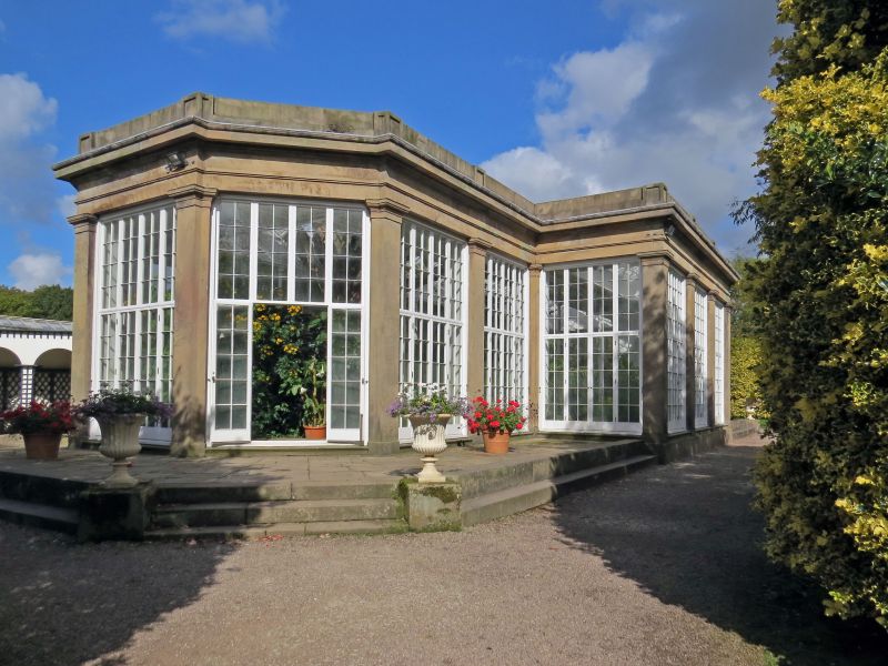
Orangery. 1818. By Lewis Wyatt. Red sandstone with glass roof. Cross plan. South-east front: 7 bays with angled bays at either end running in ½ 2.3.2. ½ rhythm. Central 3 bays project by the dimension of one bay. Stone plinth. Monolithic pilasters with unmoulded base blocks and cyma reversa capitals. Full entablature above with sunken panels above pilasters. Windows of 4 lights each with double doorways to centre of each. Originally these plate glass windows were of smaller panes as are the upper halves of the windows, each light containing 2 x 4 panes. Rear facade is without windows. Original glazed roof probably replaced in late C19 and now supported internally by slender iron pillars with C20 tubular arched supports.
Listing NGR: SJ7515580812
External links are from the relevant listing authority and, where applicable, Wikidata. Wikidata IDs may be related buildings as well as this specific building. If you want to add or update a link, you will need to do so by editing the Wikidata entry.


Other nearby listed buildings