Latitude: 53.2474 / 53°14'50"N
Longitude: -2.794 / 2°47'38"W
OS Eastings: 347117
OS Northings: 372559
OS Grid: SJ471725
Mapcode National: GBR 8ZXW.XL
Mapcode Global: WH883.1MTT
Plus Code: 9C5V66W4+XC
Entry Name: Smithy Farmhouse
Listing Date: 1 June 1967
Grade: II
Source: Historic England
Source ID: 1330216
English Heritage Legacy ID: 55404
ID on this website: 101330216
Location: Dunham-on-the-Hill, Cheshire West and Chester, Cheshire, WA6
County: Cheshire West and Chester
Civil Parish: Dunham-on-the-Hill and Hapsford
Built-Up Area: Dunham-on-the-Hill
Traditional County: Cheshire
Lieutenancy Area (Ceremonial County): Cheshire
Church of England Parish: Dunham-on-the-Hill St Luke
Church of England Diocese: Chester
Tagged with: Farmhouse
SJ 47SE DUNHAM ON THE HILL C.P. THE VILLAGE (WEST SIDE)
5/21 Smithy Farmhouse
1.6.67
GV II
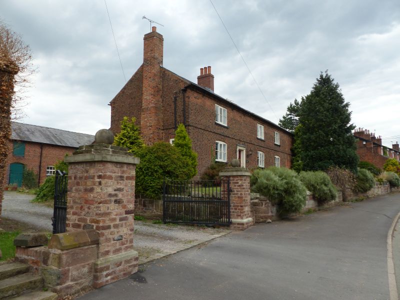
Farmhouse. C17th altered and added to. Brown brick, stone plinth, part on natural rock, slate roof. 3 windows. 3-light timber casements have cambered heads. Replaced doorcase and door. Right hand end is altered and contains blocked 1st floor opening. First floor brick band. Diagonally set eaves dentils. Projecting stepped brick stack at left and is added. Replaced brick stack on ridge. Lean to additions at rear, one with access only at upper level via replaced timber ladder.
Listing NGR: SJ4711772559
External links are from the relevant listing authority and, where applicable, Wikidata. Wikidata IDs may be related buildings as well as this specific building. If you want to add or update a link, you will need to do so by editing the Wikidata entry.


Other nearby listed buildings