Approximate Location Map
Large Map »
Latitude: 53.1628 / 53°9'45"N
Longitude: -2.2115 / 2°12'41"W
OS Eastings: 385956
OS Northings: 362869
OS Grid: SJ859628
Mapcode National: GBR 12B.RPM
Mapcode Global: WHBC1.0R5Q
Plus Code: 9C5V5Q7Q+4C
Entry Name: 28-32, High Street
Listing Date: 4 April 1975
Grade: II
Source: Historic England
Source ID: 1330327
English Heritage Legacy ID: 55883
ID on this website: 101330327
Location: Congleton, Cheshire East, Cheshire, CW12
County: Cheshire East
Civil Parish: Congleton
Built-Up Area: Congleton
Traditional County: Cheshire
Lieutenancy Area (Ceremonial County): Cheshire
Church of England Parish: Congleton Team
Church of England Diocese: Chester
Tagged with: Shop
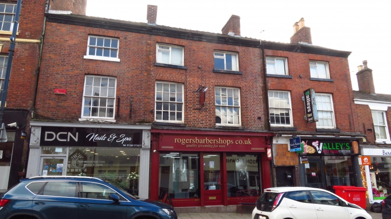
1.
5144 HIGH STREET
(South Side)
Nos 28 to 32 (even)
SJ 8562 1/91
II GV
2.
Early C19. Red brick; 3 storeys; 5 sash windows with flat brick arches;
plain wood eaves; slates. Semi-circular headed passage-way on right hand
side. Modern shop fronts.
Nos 26 to 32 (even) form a group.
Listing NGR: SJ8595662869
External links are from the relevant listing authority and, where applicable, Wikidata. Wikidata IDs may be related buildings as well as this specific building. If you want to add or update a link, you will need to do so by editing the Wikidata entry.


Other nearby listed buildings
