Approximate Location Map
Large Map »
Latitude: 53.3352 / 53°20'6"N
Longitude: -2.8003 / 2°48'1"W
OS Eastings: 346804
OS Northings: 382332
OS Grid: SJ468823
Mapcode National: GBR 8YWW.J4
Mapcode Global: WH87P.YFPH
Plus Code: 9C5V85PX+3V
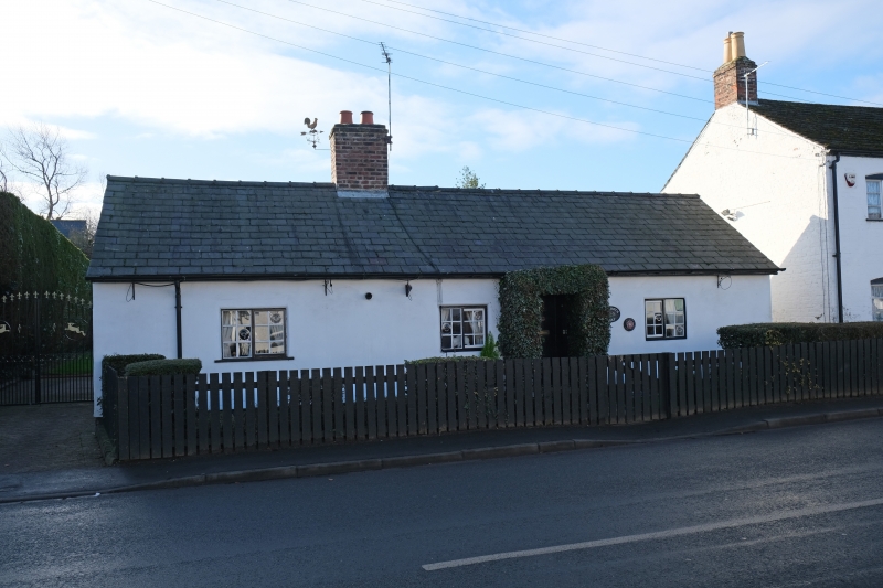
Entry Name: 46, High Street
Listing Date: 28 January 1971
Grade: II
Source: Historic England
Source ID: 1330342
English Heritage Legacy ID: 55972
ID on this website: 101330342
SJ 48 SE HALE C.P. HIGH STREET
(South Side)
4/18 No.46
28.1.71 II
Limewashed brick single storey cottage, C18, with stone plinth. Slate
roof, centre chimney. 3 small horizontal sliding sash windows.
Boarded front door.
Listing NGR: SJ4680482332
External links are from the relevant listing authority and, where applicable, Wikidata. Wikidata IDs may be related buildings as well as this specific building. If you want to add or update a link, you will need to do so by editing the Wikidata entry.


Other nearby listed buildings
