Latitude: 50.3711 / 50°22'16"N
Longitude: -4.0798 / 4°4'47"W
OS Eastings: 252193
OS Northings: 54426
OS Grid: SX521544
Mapcode National: GBR NZ.TV7Q
Mapcode Global: FRA 28B2.4C8
Plus Code: 9C2Q9WCC+F3
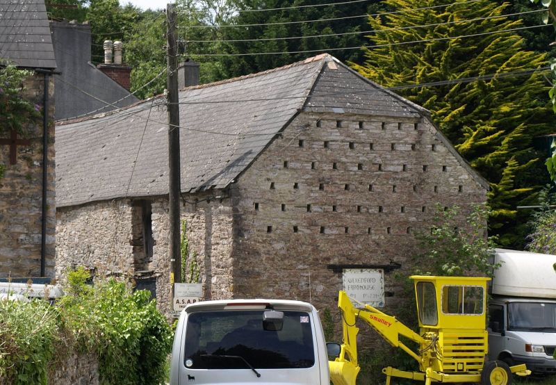
Entry Name: Outbuilding Adjoining North East of Wixenford Farmhouse
Listing Date: 1 May 1975
Last Amended: 9 November 1998
Grade: II
Source: Historic England
Source ID: 1330553
English Heritage Legacy ID: 473275
ID on this website: 101330553
Location: Billacombe, Plymouth, Devon, PL9
County: City of Plymouth
Electoral Ward/Division: Plymstock Radford
Parish: Non Civil Parish
Traditional County: Devon
Lieutenancy Area (Ceremonial County): Devon
Tagged with: Appendage
PLYMOUTH
SX55SW COLESDOWN HILL 740-1/8/581 (West side (off)) 01/05/75 Plymstock, Billacombe Outbuilding adjoining north-east of Wixenford Farmhouse (Formerly Listed as: COLESDOWN HILL, Plymstock Outbuilding adjoining north-east of Wixenford)
GV II
Barn. C18. Local rubble walls; steep asbestos slate roof with half-hipped end on right. Rectangular plan. 2 storeys; long, low range with some openings boarded up. 1st floor has 2 widely-spaced doorways and ground floor has 1 window and 3 doorways, the right-hand doorway with an old panelled door. Right-hand return has 6 tiers of pigeon holes to upper part. INTERIOR: not inspected but likely to retain original floor and roof structures.
Listing NGR: SX5219354426
External links are from the relevant listing authority and, where applicable, Wikidata. Wikidata IDs may be related buildings as well as this specific building. If you want to add or update a link, you will need to do so by editing the Wikidata entry.


Other nearby listed buildings