Latitude: 52.3542 / 52°21'15"N
Longitude: 0.0068 / 0°0'24"E
OS Eastings: 536773
OS Northings: 274801
OS Grid: TL367748
Mapcode National: GBR K42.8KH
Mapcode Global: VHHJG.23G2
Plus Code: 9F429234+MP
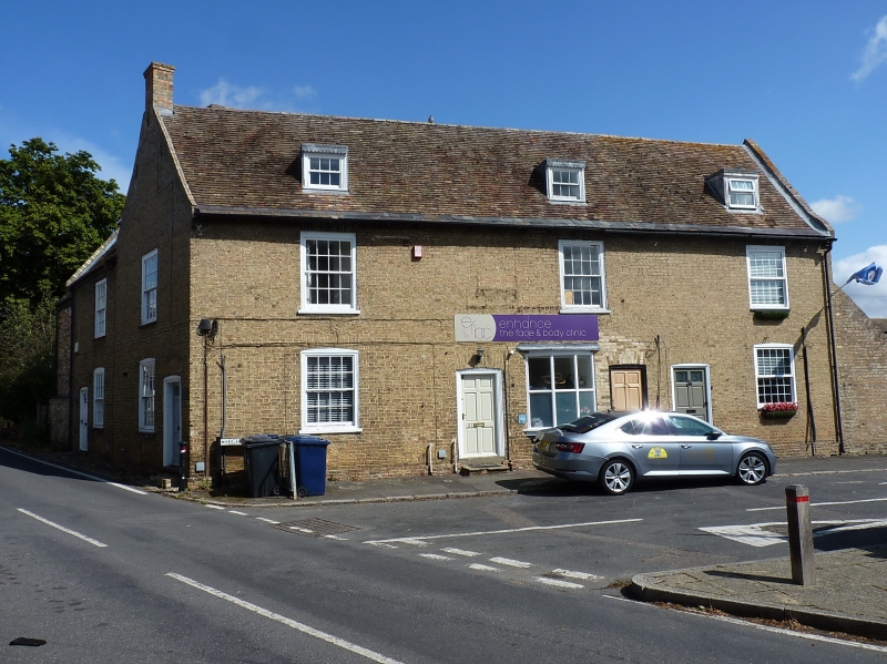
Entry Name: 27 and 29, High Street
Listing Date: 4 November 1982
Grade: II
Source: Historic England
Source ID: 1330733
English Heritage Legacy ID: 53758
ID on this website: 101330733
Location: Bluntisham, Huntingdonshire, Cambridgeshire, PE28
County: Cambridgeshire
District: Huntingdonshire
Civil Parish: Bluntisham
Built-Up Area: Bluntisham
Traditional County: Huntingdonshire
Lieutenancy Area (Ceremonial County): Cambridgeshire
Church of England Parish: Bluntisham cum Earith St Mary
Church of England Diocese: Ely
Tagged with: Building
BLUNTISHAM HIGH STREET 1. 5140 Nos 27 and 29 TL 36 74 17/11 II GV
2. At junction with East Street. Late C18 houses. Two-storeys with attics, L-plan with mansard roofed outshuts. Gault brick, plain tile roofs with parapet gables, end stacks and three internal stacks to outshuts. Three flat-roofed dormer windows with hung sashes and glazing bars. First floor three window range of hung sashes with glazing bars. Inserted central shop window, two flanking hung sash windows and two doorways to left and right hand in segmental arches.
Listing NGR: TL3677374801
External links are from the relevant listing authority and, where applicable, Wikidata. Wikidata IDs may be related buildings as well as this specific building. If you want to add or update a link, you will need to do so by editing the Wikidata entry.


Other nearby listed buildings