Latitude: 52.1959 / 52°11'45"N
Longitude: 0.4254 / 0°25'31"E
OS Eastings: 565869
OS Northings: 258065
OS Grid: TL658580
Mapcode National: GBR NBK.6DP
Mapcode Global: VHJGX.B28G
Plus Code: 9F425CWG+85
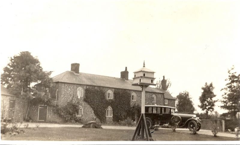
Entry Name: The Limes, Wall, Archway, Stable and Cartshed
Listing Date: 25 April 1984
Grade: II
Source: Historic England
Source ID: 1331441
English Heritage Legacy ID: 49255
ID on this website: 101331441
Location: Ditton Green, East Cambridgeshire, CB8
County: Cambridgeshire
District: East Cambridgeshire
Civil Parish: Woodditton
Traditional County: Cambridgeshire
Lieutenancy Area (Ceremonial County): Cambridgeshire
Church of England Parish: Woodditton St Mary
Church of England Diocese: Ely
Tagged with: Architectural structure
TL 65 NE WOODDITTON DITTON GREEN
7/176 The Limes, walk archway, stable and cartshed
GV II
Farmhouse, early C19. Flint with red brick dressings, hipped slate roof, two ridge stacks. Two storeys with wing at angle to right hand. Four first floor casement windows with glazing bars shaped to two-centred arches; similar larger ground floor windows. Half-glazed panelled entrance door in two-centred arch. Plinth with red brick band. Wall and archway to left hand of farmhouse links stable and cartshed with similar building details.
Listing NGR: TL6586958065
External links are from the relevant listing authority and, where applicable, Wikidata. Wikidata IDs may be related buildings as well as this specific building. If you want to add or update a link, you will need to do so by editing the Wikidata entry.


Other nearby listed buildings