Approximate Location Map
Large Map »
Latitude: 51.63 / 51°37'47"N
Longitude: -0.7522 / 0°45'8"W
OS Eastings: 486460
OS Northings: 193089
OS Grid: SU864930
Mapcode National: GBR D54.NNR
Mapcode Global: VHDW4.X959
Plus Code: 9C3XJ6HX+X4
Entry Name: 20 and 22, White Hart Street
Listing Date: 28 June 1973
Grade: II
Source: Historic England
Source ID: 1332376
English Heritage Legacy ID: 46175
ID on this website: 101332376
Location: High Wycombe, Buckinghamshire, HP11
County: Buckinghamshire
Electoral Ward/Division: Abbey
Parish: Non Civil Parish
Built-Up Area: High Wycombe
Traditional County: Buckinghamshire
Lieutenancy Area (Ceremonial County): Buckinghamshire
Church of England Parish: High Wycombe All Saints
Church of England Diocese: Oxford
Tagged with: Building
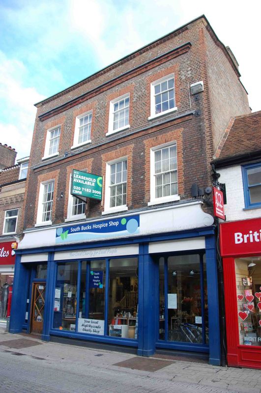
WHITE HART STREET
1.
963
(North Side)
Nos 20 and 22
SU 8695 SW 3/52
II
2.
C18 with altered ground floors. Vitruous brick with red brick dressings.
3 storeys with moulded stringcourse over first floor windows, moulded brick
cornice and parapet, coping in moulded brick with angle stones, 4 window
front of sashes in reveals with glazing bars, flat arches. Modern shop
windows without cornices.
Listing NGR: SU8646193095
External links are from the relevant listing authority and, where applicable, Wikidata. Wikidata IDs may be related buildings as well as this specific building. If you want to add or update a link, you will need to do so by editing the Wikidata entry.


Other nearby listed buildings
