Approximate Location Map
Large Map »
Latitude: 51.6018 / 51°36'6"N
Longitude: -0.6286 / 0°37'43"W
OS Eastings: 495075
OS Northings: 190105
OS Grid: SU950901
Mapcode National: GBR F70.HW3
Mapcode Global: VHFSP.2Z0Z
Plus Code: 9C3XJ92C+PG
Entry Name: Mile Stone
Listing Date: 24 April 1985
Grade: II
Source: Historic England
Source ID: 1332640
English Heritage Legacy ID: 43731
ID on this website: 101332640
Location: Buckinghamshire, HP9
County: Buckinghamshire
Civil Parish: Beaconsfield
Built-Up Area: Beaconsfield
Traditional County: Buckinghamshire
Lieutenancy Area (Ceremonial County): Buckinghamshire
Church of England Parish: Beaconsfield
Church of England Diocese: Oxford
Tagged with: Milestone
SU 99 SE BEACONSFIELD LONDON ROAD
2/96
Mile Stone
-
- II
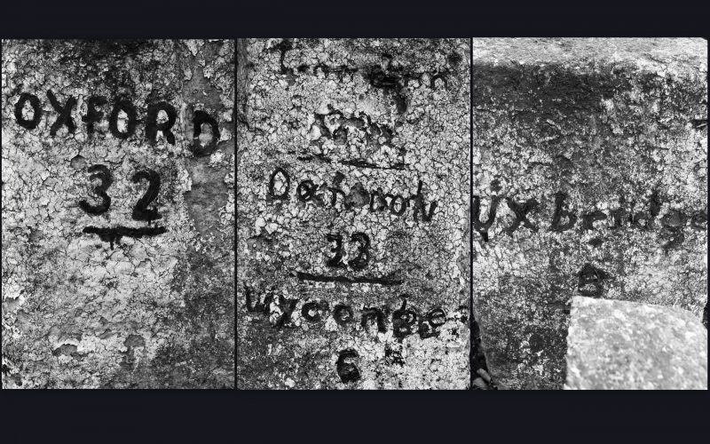
C19. Whitewashed stone with black block lettering. Square; pyramid top.
On front; London 23, Wycombe 6; on left hand side; Uxbridge 8.
Listing NGR: SU9507590105
External links are from the relevant listing authority and, where applicable, Wikidata. Wikidata IDs may be related buildings as well as this specific building. If you want to add or update a link, you will need to do so by editing the Wikidata entry.


Other nearby listed buildings
