Latitude: 50.6405 / 50°38'25"N
Longitude: -3.4749 / 3°28'29"W
OS Eastings: 295806
OS Northings: 83354
OS Grid: SX958833
Mapcode National: GBR P2.MH2D
Mapcode Global: FRA 37MC.S3B
Plus Code: 9C2RJGRG+63
Entry Name: Studd Chest Tomb in North-East Corner of the Churchyard of the Church of All Saints
Listing Date: 2 December 1988
Grade: II
Source: Historic England
Source ID: 1333947
English Heritage Legacy ID: 85892
ID on this website: 101333947
Location: All Saints' Church, Kenton, Teignbridge, Devon, EX6
County: Devon
District: Teignbridge
Civil Parish: Kenton
Built-Up Area: Kenton
Traditional County: Devon
Lieutenancy Area (Ceremonial County): Devon
Church of England Parish: Kenton All Saints
Church of England Diocese: Exeter
Tagged with: Chest tomb
SX 98 SE
6/216
KENTON
CHURCH STREET (north side), Kenton
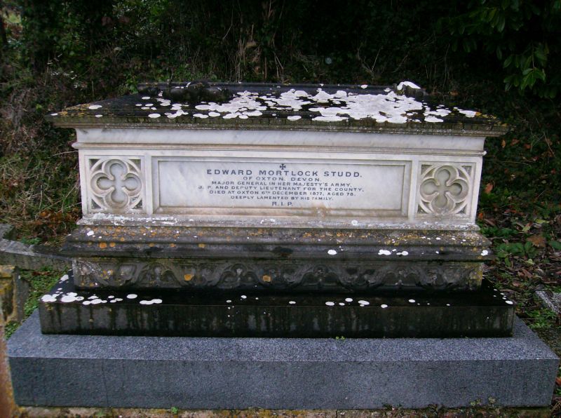
Studd chest tomb in north-east corner of the churchyard of the Church of All Saints
GV
II
Chest tomb. Late C19. Marble and granite. A marble chest with coped lid raised
high on a marble plinth and polished granite base. The chest has quatrefoil
decoration to the ends, returning round the sides and the plinth is also decorated
with blind tracery. The coped lid is decorated with a foliated cross. Inscription
on chest commemorates Edward Mortlock Studd, died 1877. Major General Studd of Oxton
(q.v.) willed that he should be buried in Oxton soil which was placed in his grave
(Griffiths).
Griffiths, G. The Book of Dawlish (1984).
Listing NGR: SX9580683354
External links are from the relevant listing authority and, where applicable, Wikidata. Wikidata IDs may be related buildings as well as this specific building. If you want to add or update a link, you will need to do so by editing the Wikidata entry.


Other nearby listed buildings