Approximate Location Map
Large Map »
Latitude: 54.402 / 54°24'7"N
Longitude: -1.7365 / 1°44'11"W
OS Eastings: 417206
OS Northings: 500754
OS Grid: NZ172007
Mapcode National: GBR JK9J.VS
Mapcode Global: WHC6D.9MC7
Plus Code: 9C6WC727+QC
Entry Name: 19, Tower Street
Listing Date: 15 October 1973
Grade: II
Source: Historic England
Source ID: 1334292
English Heritage Legacy ID: 439611
ID on this website: 101334292
Location: Richmond, North Yorkshire, DL10
County: North Yorkshire
District: Richmondshire
Civil Parish: Richmond
Built-Up Area: Richmond
Traditional County: Yorkshire
Lieutenancy Area (Ceremonial County): North Yorkshire
Church of England Parish: Richmond with Holy Trinity with Hudswell
Church of England Diocese: Leeds
Tagged with: Building
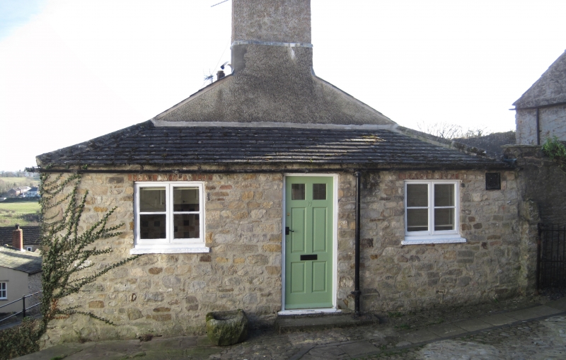
1. TOWER STREET
1549 (South Side)
No 19
NZ 1700 NW 1/423
GV
II
2.
Probably early-mid C19. One storey, rendered, to this elevation. Two
modern windows and modern doer. Adjoins Castle Terrace. Included solely
as part of a group.
Nos 19 to 23 (odd) form a group
Listing NGR: NZ1720600754
External links are from the relevant listing authority and, where applicable, Wikidata. Wikidata IDs may be related buildings as well as this specific building. If you want to add or update a link, you will need to do so by editing the Wikidata entry.


Other nearby listed buildings
