Latitude: 51.2837 / 51°17'1"N
Longitude: 1.0859 / 1°5'9"E
OS Eastings: 615294
OS Northings: 158365
OS Grid: TR152583
Mapcode National: GBR TY2.KCB
Mapcode Global: VHLGF.RZYS
Plus Code: 9F3373MP+F9
Entry Name: 31, Northgate
Listing Date: 7 September 1973
Grade: II
Source: Historic England
Source ID: 1334338
English Heritage Legacy ID: 439805
ID on this website: 101334338
Location: Northgate, Canterbury, Kent, CT1
County: Kent
District: Canterbury
Electoral Ward/Division: Northgate
Parish: Non Civil Parish
Built-Up Area: Canterbury
Traditional County: Kent
Lieutenancy Area (Ceremonial County): Kent
Tagged with: Building
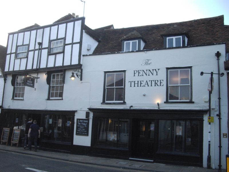
1.
944 NORTHGATE
(North West Side)
No 31
TR 1558 SW 3/586
II GV
2.
A timber-framed building refaced in the C18, 3 storeys, mostly colourwashed
but the 2nd floor has imitation timber-framing. 2 hipped dormers on tiled
roof. 2 sashes with glazing bars intact in moulded architraves. Shop front.
Nos 28 to 37 (consec) form a group.
Listing NGR: TR1529258370
External links are from the relevant listing authority and, where applicable, Wikidata. Wikidata IDs may be related buildings as well as this specific building. If you want to add or update a link, you will need to do so by editing the Wikidata entry.


Other nearby listed buildings