Latitude: 50.5803 / 50°34'49"N
Longitude: -3.47 / 3°28'12"W
OS Eastings: 296017
OS Northings: 76652
OS Grid: SX960766
Mapcode National: GBR P2.RJD6
Mapcode Global: FRA 37MJ.MYX
Plus Code: 9C2RHGJH+4X
Entry Name: Stanley House
Listing Date: 17 July 1951
Grade: II
Source: Historic England
Source ID: 1334489
English Heritage Legacy ID: 84341
ID on this website: 101334489
Location: Dawlish, Teignbridge, Devon, EX7
County: Devon
District: Teignbridge
Civil Parish: Dawlish
Built-Up Area: Dawlish
Traditional County: Devon
Lieutenancy Area (Ceremonial County): Devon
Church of England Parish: Dawlish St Gregory
Church of England Diocese: Exeter
Tagged with: House
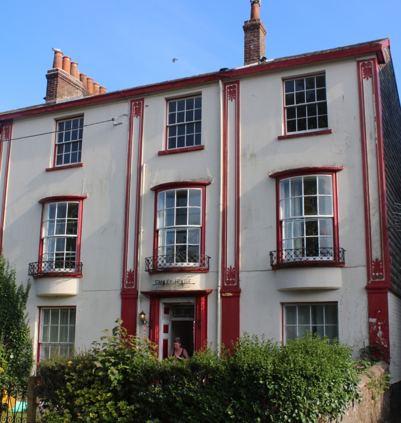
SX 9676 DAWLISH BRUNSWICK PLACE
8/23 No 4 (Stanley House)
17.7.51
GV II
Early C19. 3 storeys stuccoed. Slate roof. 3 windows which are slightly
bowed on the 1st floor and have cast iron flower guards. Pilasters with
anthenian motif. Doorcase with pilasters and fanlight. The side elevation
is hung with slates.
Listing NGR: SX9601776652
External links are from the relevant listing authority and, where applicable, Wikidata. Wikidata IDs may be related buildings as well as this specific building. If you want to add or update a link, you will need to do so by editing the Wikidata entry.


Other nearby listed buildings