Latitude: 50.6088 / 50°36'31"N
Longitude: -3.6966 / 3°41'47"W
OS Eastings: 280045
OS Northings: 80156
OS Grid: SX800801
Mapcode National: GBR QL.8407
Mapcode Global: FRA 374G.HMV
Plus Code: 9C2RJ853+G8
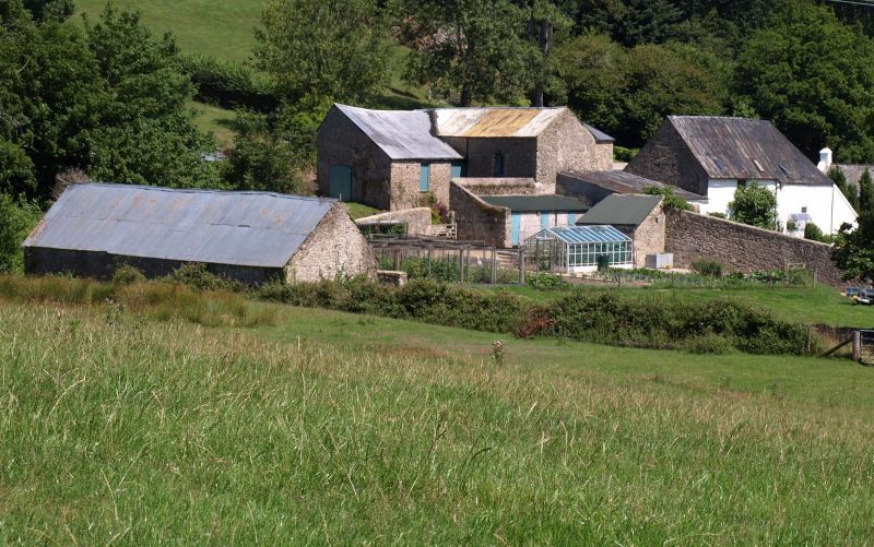
Entry Name: Range of Outbuildings About 20 Metres West of Plumley Farmhouse
Listing Date: 3 July 1986
Grade: II
Source: Historic England
Source ID: 1334511
English Heritage Legacy ID: 84469
ID on this website: 101334511
Location: Hawkmoor Park, Teignbridge, Devon, TQ13
County: Devon
District: Teignbridge
Civil Parish: Bovey Tracey
Traditional County: Devon
Lieutenancy Area (Ceremonial County): Devon
Church of England Parish: Bovey Tracey St Peter, St Paul and St Thomas
Church of England Diocese: Exeter
Tagged with: Agricultural structure
BOVEY TRACEY SX 88 SW
2/26 Range of buildings about - 20 metres west of Plumley Farmhouse GV II
U-shaped range of farm buildings. C19, but incorporating a late C16 or early C17 barn at west end of southern arm. North and west arms are of stone rubble, south arm has solid walls covered with roughcast; in the case of the early barn the walling material is cob on a stone footing, but the upper part of the south wall has been rebuilt in yellow brick and the north-west corner repaired with concrete block. Slated roofs with late C19 glazed ridge-tiles, except for a section of corrugated iron at either end of the southern arm; at the west end of this arm, one end of the early barn has been reduced in height and given a lean-to corrugated iron roof. U- shaped on plan. Mostly 2-storeyed, but with single-storeyed sections, including the west end of the early barn. The latter appears to have been altered in C18 by building an internal stone wall, dividing off the single-storeyed barn section on the west from the 2-storeyed section on the east; it is not possible to be certain that the whole building was originally single-storeyed. Its north front, towards the courtyard, has a small doorway at left-hand end; plank door with wrought-iron strap-hinges, straight-headed door-frame with pegged joints. At right-hand end is a large doorway with similar frame; pair of plank doors with wrought-iron strap- hinges, the upper part of left-hand door having been replaced in C19 and made to open independently. The older doors of the pair have early scratched graffiti consisting of initials and dates 1768 and 1779. Interior has at east end upper floor-beams with run-out stops, possibly re-used. In upper storey of east gable are 2 slit windows (now blocked by a later building) with deeply splayed embrasures; one is just above floor level and the other almost at the apex of the gable. On the outer face the slits have plain rectangular wood frames with pegged joints. 3 roof-trusses survive, the western one built into the stone wall dividing the storeyed section from the barn; the trusses have plain feet sitting directly on the wall-tops, halved dovetailed collars, notched apexes and through purlins. The main feature of the C19 buildings is a pit for a water-wheel at rear of the western section; iron screw survives inside the building.
Listing NGR: SX8004580156
External links are from the relevant listing authority and, where applicable, Wikidata. Wikidata IDs may be related buildings as well as this specific building. If you want to add or update a link, you will need to do so by editing the Wikidata entry.


Other nearby listed buildings