Approximate Location Map
Large Map »
Latitude: 53.0174 / 53°1'2"N
Longitude: -1.7333 / 1°44'0"W
OS Eastings: 417985
OS Northings: 346709
OS Grid: SK179467
Mapcode National: GBR 48Q.SQ7
Mapcode Global: WHCF5.BFV4
Plus Code: 9C5W2788+XM
Entry Name: 1 and 2, Victoria Square
Listing Date: 14 February 1974
Grade: II
Source: Historic England
Source ID: 1335160
English Heritage Legacy ID: 79936
ID on this website: 101335160
Location: Ashbourne, Derbyshire Dales, Derbyshire, DE6
County: Derbyshire
District: Derbyshire Dales
Civil Parish: Ashbourne
Built-Up Area: Ashbourne
Traditional County: Derbyshire
Lieutenancy Area (Ceremonial County): Derbyshire
Church of England Parish: Ashbourne St Oswald
Church of England Diocese: Derby
Tagged with: Building
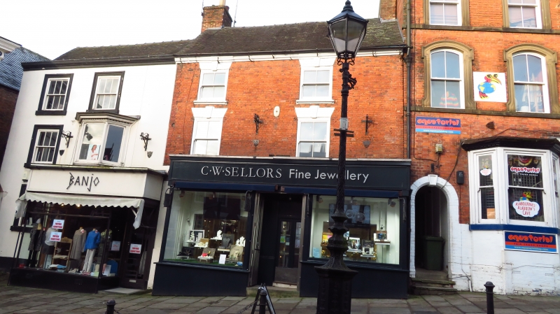
VICTORIA SQUARE
1.
783
(West Side)
Nos 1 & 2
SK 14 NE 1/79
II GV
2.
C18. Red brick but facade of No 1 stuccoed. Eaves cornice and tiled roof. 3
storeys, 4 windows without glazing bars. Modern shop fronts.
All the listed buildings in Victoria Square form a group.
Listing NGR: SK1798546709
External links are from the relevant listing authority and, where applicable, Wikidata. Wikidata IDs may be related buildings as well as this specific building. If you want to add or update a link, you will need to do so by editing the Wikidata entry.


Other nearby listed buildings
