Approximate Location Map
Large Map »
Latitude: 53.0668 / 53°4'0"N
Longitude: -1.7366 / 1°44'11"W
OS Eastings: 417748
OS Northings: 352209
OS Grid: SK177522
Mapcode National: GBR 483.RRW
Mapcode Global: WHCDZ.959Q
Plus Code: 9C5W3787+P9
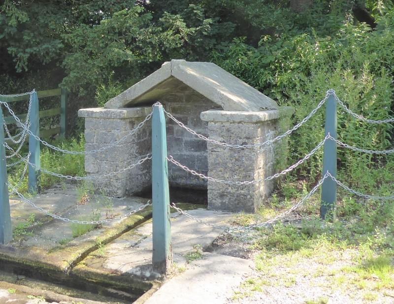
Entry Name: Town Well
Listing Date: 13 September 1967
Grade: II
Source: Historic England
Source ID: 1335261
English Heritage Legacy ID: 80403
ID on this website: 101335261
Location: Tissington, Derbyshire Dales, Derbyshire, DE6
County: Derbyshire
District: Derbyshire Dales
Civil Parish: Tissington and Lea Hall
Traditional County: Derbyshire
Lieutenancy Area (Ceremonial County): Derbyshire
Church of England Parish: Tissington St Mary
Church of England Diocese: Derby
Tagged with: Well
SK 17 52 PARISH OF TISSINGTON THE GREEN
11/133 (East Side)
13.9.1967 Town Well
GV II
Well. Perhaps C18. A small stone structure with limestone side slabs and a
gabled gritstone slab roof.
Listing NGR: SK1774852209
External links are from the relevant listing authority and, where applicable, Wikidata. Wikidata IDs may be related buildings as well as this specific building. If you want to add or update a link, you will need to do so by editing the Wikidata entry.


Other nearby listed buildings
