Approximate Location Map
Large Map »
Latitude: 53.0826 / 53°4'57"N
Longitude: -1.4785 / 1°28'42"W
OS Eastings: 435026
OS Northings: 354063
OS Grid: SK350540
Mapcode National: GBR 6BX.R0W
Mapcode Global: WHDG1.8S54
Plus Code: 9C5W3GMC+3H
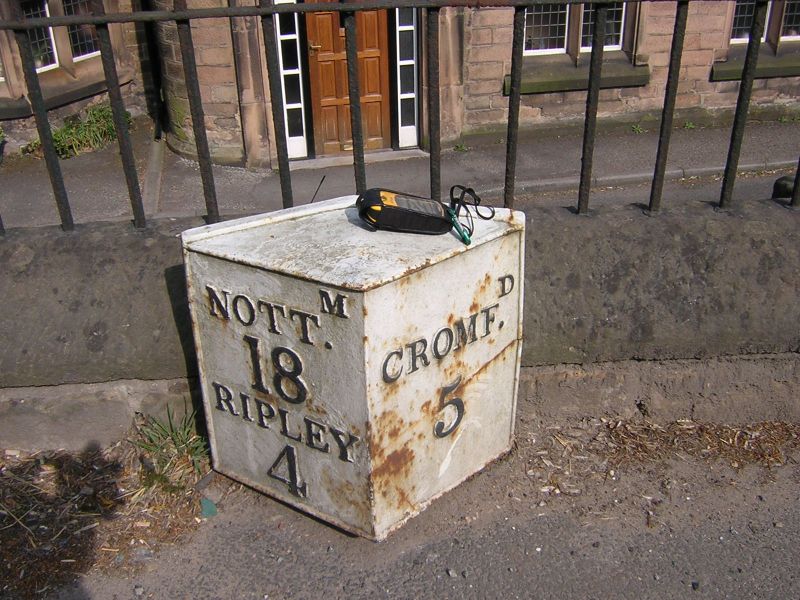
Entry Name: Milepost 20 Metres South East of the Former Rising Sun Public House
Listing Date: 14 August 1985
Grade: II
Source: Historic England
Source ID: 1335288
English Heritage Legacy ID: 78663
ID on this website: 101335288
Location: Crich, Amber Valley, Derbyshire, DE4
County: Derbyshire
District: Amber Valley
Civil Parish: Crich
Built-Up Area: Crich
Traditional County: Derbyshire
Lieutenancy Area (Ceremonial County): Derbyshire
Church of England Parish: Crich St Mary
Church of England Diocese: Derby
Tagged with: Milestone
SK 35 SW PARISH OF CRICH THE COMMON
3/15 (East Side)
Milepost 20 metres south-east
of the former Rising Sun PH
II
Milepost. Early C19. Diamond section cast iron milepost on short circular
shaft. North-west face reads NOTTm 18 RIPLEY 4. South-west face reads CROMFd 5.
Listing NGR: SK3502654063
External links are from the relevant listing authority and, where applicable, Wikidata. Wikidata IDs may be related buildings as well as this specific building. If you want to add or update a link, you will need to do so by editing the Wikidata entry.


Other nearby listed buildings
