Latitude: 53.0236 / 53°1'25"N
Longitude: -1.4779 / 1°28'40"W
OS Eastings: 435114
OS Northings: 347498
OS Grid: SK351474
Mapcode National: GBR 6CP.K4N
Mapcode Global: WHDGF.88GC
Plus Code: 9C5W2GFC+FR
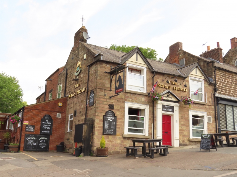
Entry Name: The Nag's Head Public House
Listing Date: 13 December 1979
Grade: II
Source: Historic England
Source ID: 1335300
English Heritage Legacy ID: 78536
ID on this website: 101335300
Location: Belper, Amber Valley, Derbyshire, DE56
County: Derbyshire
District: Amber Valley
Civil Parish: Belper
Built-Up Area: Belper
Traditional County: Derbyshire
Lieutenancy Area (Ceremonial County): Derbyshire
Church of England Parish: Belper St Peter
Church of England Diocese: Derby
Tagged with: Pub
HIGH PAVEMENT 1. 5167 (North Side) The Nag's Head Public House SK 3547 3/137 II 2. Earlier/mid C19 facade, possibly to earlier building. Painted white over coursed stone. Slate roof with 2 gables. Symmetrical facade. Two storeys. Two windows sashes (no glazing bars) in broad moulded and boxed frames. Six panelled centre door with pediment and pilasters.
Listing NGR: SK3511447498
External links are from the relevant listing authority and, where applicable, Wikidata. Wikidata IDs may be related buildings as well as this specific building. If you want to add or update a link, you will need to do so by editing the Wikidata entry.


Other nearby listed buildings