Latitude: 52.982 / 52°58'55"N
Longitude: -1.4865 / 1°29'11"W
OS Eastings: 434575
OS Northings: 342859
OS Grid: SK345428
Mapcode National: GBR 6D8.308
Mapcode Global: WHDGM.49FS
Plus Code: 9C4WXGJ7+QC
Entry Name: Duffield Baptist Church and Attached House, Walls and Railings
Listing Date: 13 February 1967
Grade: II
Source: Historic England
Source ID: 1335329
English Heritage Legacy ID: 78872
ID on this website: 101335329
Location: Duffield Evangelical Baptist Church, Duffieldbank, Amber Valley, Derbyshire, DE56
County: Derbyshire
District: Amber Valley
Civil Parish: Duffield
Built-Up Area: Duffield
Traditional County: Derbyshire
Lieutenancy Area (Ceremonial County): Derbyshire
Church of England Parish: Duffield St Alkmund
Church of England Diocese: Derby
Tagged with: Architectural structure
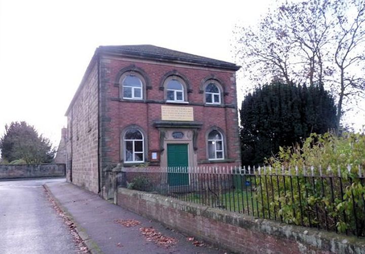
SK 34 SW PARISH OF DUFFIELD TOWN STREET 3/33 (East Side) Duffield Baptist Church and attached house, 13.2.67 walls and railings GV II Chapel and attached house. Chapel dated 1830, house dated 1877. Coursed squared gritstone and red brick, with gritstone dressings. Hipped Welsh slate roof with two lateral stacks. Moulded stone eaves cornice. Two storeys, L-plan. North elevation is chapel entrance. Three bays, brick with stone quoins and sill bands. Central doorway with moulded stone surround, date plaque above and cornice hoodmould on heavy moulded consoles. Double doors with raised and fielded panels, flanked on each side by round-arched windows with moulded stone surrounds. Linked to two similar windows above by a recessed panel enclosed at the top by an outer arch with moulded stone surround. Similar window above the door, also with an outer arch. All the windows have C20 glazing. South elevation of chapel has three tall round-arched windows with moulded stone surrounds set within a larger round-arched blind panel. The house forms the L-range behind and has two tiers of plain round-arched windows. Low walls surmounted by iron railings attached to north and west and enclosing the burial ground.
Listing NGR: SK3457542859
External links are from the relevant listing authority and, where applicable, Wikidata. Wikidata IDs may be related buildings as well as this specific building. If you want to add or update a link, you will need to do so by editing the Wikidata entry.


Other nearby listed buildings