Latitude: 53.2292 / 53°13'45"N
Longitude: -1.2937 / 1°17'37"W
OS Eastings: 447246
OS Northings: 370472
OS Grid: SK472704
Mapcode National: GBR 7BR.HQW
Mapcode Global: WHDFK.3368
Plus Code: 9C5W6PH4+MG
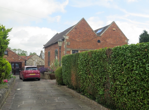
Entry Name: Former Presbyterian Chapel
Listing Date: 11 July 1980
Grade: II
Source: Historic England
Source ID: 1335420
English Heritage Legacy ID: 79239
ID on this website: 101335420
Location: Bolsover, Derbyshire, S44
County: Derbyshire
District: Bolsover
Civil Parish: Old Bolsover
Built-Up Area: Bolsover
Traditional County: Derbyshire
Lieutenancy Area (Ceremonial County): Derbyshire
Church of England Parish: Bolsover St Mary and St Laurence
Church of England Diocese: Derby
Tagged with: Chapel
SK 4771 TOWN OF OLD BOLSOVER HIGH STREET 16/69 (North side) 11.7.80 Former Presbyterian Chapel II
Presbyterian chapel, at the time of re-survey being converted into a house. Said to date from 1662. Red brick in monk bond with ashlar quoins. Tall single storey. Broad twin gabled building with plain tile roof. The west elevation has two large rectangular windows under slightly arched lintels. The south elevation has two rectangular windows high up, the lintels forming part of a continuous stone band. The interior has three wall memorials of 1723, 1837 and 1877. The building served as the presbyterian meeting house until 1893 when a new chapel was built adjoining (demolished 1986) and the old chapel became the sunday school. Source: Downman's 'History of Bolsover' 1895.
Listing NGR: SK4724670472
External links are from the relevant listing authority and, where applicable, Wikidata. Wikidata IDs may be related buildings as well as this specific building. If you want to add or update a link, you will need to do so by editing the Wikidata entry.


Other nearby listed buildings