Approximate Location Map
Large Map »
Latitude: 54.9404 / 54°56'25"N
Longitude: -2.9442 / 2°56'39"W
OS Eastings: 339607
OS Northings: 561044
OS Grid: NY396610
Mapcode National: GBR 7CW9.DT
Mapcode Global: WH7ZW.R25Y
Plus Code: 9C6VW3R4+58
Entry Name: Milestone at National Grid Reference Ny 39610 61400
Listing Date: 16 January 1984
Grade: II
Source: Historic England
Source ID: 1335570
English Heritage Legacy ID: 77939
ID on this website: 101335570
Location: Cumberland, Cumbria, CA6
County: Cumbria
District: Carlisle
Civil Parish: Rockcliffe
Traditional County: Cumberland
Lieutenancy Area (Ceremonial County): Cumbria
Church of England Parish: Blackford St John the Baptist
Church of England Diocese: Carlisle
Tagged with: Milestone
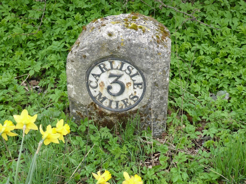
NY 36 SE ROCKCLIFFE HARKER
7/148 Milestone at
NGR NY 39610 61400
II
Milestone. Probably 1793 for Carlisle-Longtown Turnpike. Whitewashed
sandstone, cast-iron plate. Rounded-top stone has recessed circular cast plate
on front, with raised lettering picked-out in black, CARLISLE 3 MILES.
Listing NGR: NY3960761044
External links are from the relevant listing authority and, where applicable, Wikidata. Wikidata IDs may be related buildings as well as this specific building. If you want to add or update a link, you will need to do so by editing the Wikidata entry.


Other nearby listed buildings
