Latitude: 53.0251 / 53°1'30"N
Longitude: -1.4799 / 1°28'47"W
OS Eastings: 434983
OS Northings: 347664
OS Grid: SK349476
Mapcode National: GBR 6CP.BNL
Mapcode Global: WHDGF.77K6
Plus Code: 9C5W2GGC+33
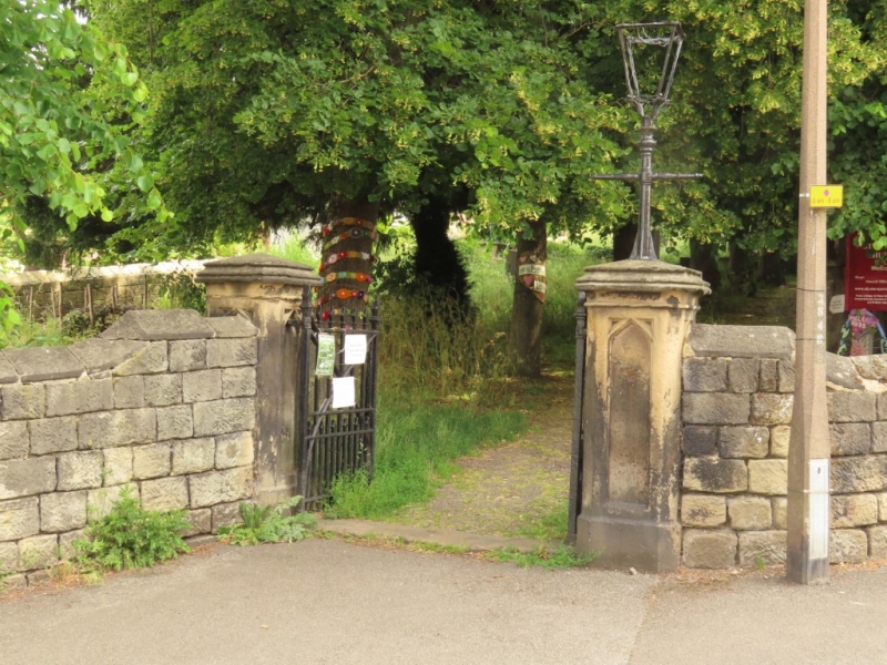
Entry Name: Churchyard Walls, Piers and Gates at Church of St Peter
Listing Date: 13 December 1979
Grade: II
Source: Historic England
Source ID: 1335694
English Heritage Legacy ID: 78465
ID on this website: 101335694
Location: Belper, Amber Valley, Derbyshire, DE56
County: Derbyshire
District: Amber Valley
Civil Parish: Belper
Built-Up Area: Belper
Traditional County: Derbyshire
Lieutenancy Area (Ceremonial County): Derbyshire
Church of England Parish: Belper St Peter
Church of England Diocese: Derby
Tagged with: Churchyard wall
CHURCH LANE 5167 (North Side) Churchyard walls, piers and gates at Church of St Peter SK 3447 NE 1/118 SK 3457 3/118 II GV 2. C19. Coursed stone coped churchyard wall to street boundary. Piers with recessed arched panels, cornices and pyramidal caps. Cast iron gates.
Listing NGR: SK3498347664
External links are from the relevant listing authority and, where applicable, Wikidata. Wikidata IDs may be related buildings as well as this specific building. If you want to add or update a link, you will need to do so by editing the Wikidata entry.


Other nearby listed buildings